AT: Harpers Ferry to Gathland State Park

It has been a very wet spring and summer in Maryland! Birch and I decided we couldn’t wait for nice weather to hit the trail so we planned a short hike from Harpers Ferry to Gathland State Park. We had done this hike before, only in the opposite direction.

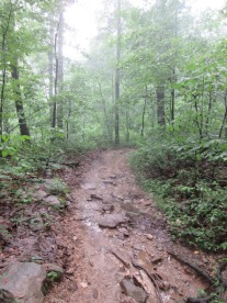
Just as we got to the Harpers Ferry parking lot it began to rain. It was a gentle mist but we were ready with our full rain gear. As we crossed the bridge next to the railroad tracks, it was interesting to see just how fast the river was flowing. The heavy rainfall this spring definitely shows itself in the water below.

Before long we were on the smooth, wide C&O canal path that is also the AT. It was a very easy hike for the first couple of miles but the rain didn’t make it easy. It POURED! We heard thunder in the distance but never worried that it was dangerous. The real challenge was navigating all the huge puddles that formed. We zig-zagged along until we got to the point where we crossed the railroad tracks and began ascending the mountain.

I remembered this section of the trail as being very steep. I was really glad to see that our latest workouts seem to be paying off because Birch and I never even had to stop to catch our breath. We just scurried up the hill! Once on “top” we still had to contend with areas of puddles but it didn’t take long before we were at the Ed Garvey shelter – the only ones there!

Before long, folks started gathering at the shelter. By the end of the evening, there were probably 40 people staying either in the shelter or in a their tents or hammocks. Wow! I think we’re in the “bubble”.  We met many nice people, including Pac Man, a thru-hiker. When I mentioned to someone that we were going to have to go without coffee because we didn’t pack it, a nice young man immediately dug through his 55 pound pack and offered us some of his. (Not surprisingly, at 55 pounds he had a lot of extra stuff!) For dinner, we had kung pao chicken. (I was testing my recipes for our next long hiking trip.)


IMG_0014

Our tent, among a sea of others!


One feature of this location that is a real bummer is the water access. The guides put the spring at .4 or .5 miles away from the shelter. This is true. The tough part is that it is a very steep trek down to the water source. Many people decided that it was easier to wait until they got to Gathland than to load up with water here. The water source was really good, though.

The next day we packed up and quickly traversed the 4 miles back to our car at Gathland State Park. I really like this part of the AT. It may not be super strenuous, but it provides an excellent opportunity to get outside.
AT: I-70 to Pen Mar

We awoke at 5:00 on Saturday, May 5, expecting rain, but finding that the forecast had delayed rain until 1:00. We hustled out of our home with two cars, parked one at our destination at Pen Mar Park, and then retreated to our beginning point where the AT crosses I-70 near Greenbrier State Park.
The first flip-floppers that we met were Kool and Kats (pictured ahead of us on the trail), who had spent the night at Pine Knob Shelter, close to I-70. Having just begun their hike at Harper’s Ferry, they were full of determination. “Where are you hiking to tonight?” Maple asked. “Maine” was the answer. “I hope you are planning to spend the night a little closer than Maine,” Maple delicately responded. “Maine” was again the retort. “We have to keep our sights on our destination,” was their explanation.

We would leap-frog with them several times during the day, as we and they rested. When they shared with us that their destination was Raven Rock Shelter, my first response was, “That shelter was dismantled two years ago,” but then—upon checking AWOL’s guidebook, it confirmed that the shelter was still there. As it turned out, the old Raven Rock Shelter was, indeed, dismantled and moved to the new AT museum to be opened at Damascus, VA., but a new, two-level shelter has been erected in its place.

I should mention one other thru-hiker that we met at the creek a mile south of Ensign Cowall Shelter. “How are you doing?” Maple innocently asked. “That’s just one question that everybody asks out here: ‘What does your pack weigh? How much food are you carrying? How are you doing?’ Let me tell you, when you are on the CDT, there’s nobody to bother you for days on end.” I laughed, and Maple persevered, “Where are you headed to tonight?” “That’s another question that people ask. I’m going as far as I’m going.” “Fair enough,” Maple responded, “What’s your trail name?” “Well,” said this stranger, “I’m not going to tell you. What does it matter?”

Maple and I filled our dromedary at the creek, and proceeded to Ensign Cowall Shelter, 8.6 miles into our hike. We were eager to set up our tent before the rain began. And surely enough, once we were set up and had introduced ourselves to those at the shelter, the rain set in—not to stop until about 4 a.m. We moved our cooking equipment and food in order to prepare our dinner at the picnic table under the overhang of the shelter. There were a couple of other flip-floppers there, one extremely talkative older man who just loved to hang out at shelters, and—later—one father with his two children, aged eight and ten, who were hiking 20+ miles a day and deciding whether or not to hike the whole AT.

5-6_0853At 5:00 the following morning, it stopped raining. Maple and I got up as soon as there was daylight, packed up our wet tent, prepared oatmeal for breakfast, and were on our way two hours later. We had a couple of engorged streams to cross that posed a bit of a risk and got our boots wet, and two and a half hours later we arrived at the new Raven Rock Shelter. The wood was new and beautiful, but the interior had been irreparably scarred by someone with an alcohol-burning stove. What a shame!

Just before we got to Raven Rock Shelter we met the sullen man we had the privilege of meeting the day before. “Hi! How you doin’,” Maple asked. The mysterious stranger mumbled something under his breath, and we passed on by. I think that this man was the most unfriendly person we have ever met on the AT. The AT is an especially social trail. It intersects with towns at so many places that you cannot reasonably expect to hike an entire day without meeting people. This sometimes happens, but it is rare. Maple and I have met the most friendly people on this planet on the AT. They are people who not only expect to meet other people, but who look forward to it. There are even people on the trail who do not hike it, but who are on it with the sole purpose of offering “trail magic”—that is, food, drink, transportation into town, or some other kindness to those who are hiking the trail. For many people, hiking the AT has been a way of renewing their faith in humanity, because of all the many kindnesses that they receive upon their way. So, this unfriendly person was an anomaly, a rare species, and because he was so rare I thought I should mention him.

5-6_1042But, moving on, Maple and I came to High Rock, where we had to descend rock and boulder after rock and boulder for 650 feet. We had to be quite careful not to slip upon the wet rocks and tree roots along our path. When we got to the bottom and had 2 miles yet to go, the rain commenced again. Maple and I donned our rain gear. We could have complained, but we were grateful to have made it so far without it raining. Soon, we were in our car; we turned up the heat, got out of our wet clothes and into dry ones, and were on our way back home.

AT: Gathland State Park to US-40

Birch and I have been itching to get back on the AT so we decided to do a repeat of our very first backpacking trip, but in the opposite direction. This gave me a real opportunity to reflect on how far we’ve come (both literally and figuratively) since I first put a backpack on less than four years ago.

4-28_1135We started our day visiting Harpers Ferry and the Flip Flop Festival. My cousin, Lynn, works for the Appalachian Trail Conservancy and she was a great hostess. We were able to leave Gathland State Park and get on the trail by 11:30 am. The first part of the trail going north is a mild incline, but we haven’t been on the trail for a while so it felt pretty steep.

I had forgotten just how beautiful the Maryland section is. It is relatively flat, but with enough hills to keep things interesting. There are rocks, but the trail is usually wide and smooth. There are no leaves on the trees yet so we had a chance to enjoy the sunshine.

4-28_1625After about 7.5 miles we turned the corner to see Dahlgren Campground. For those who haven’t been there before but have spent time on the AT, this is a VERY unusual place. It has about 6 camp spots, each with its own picnic table and a tent platform. But the biggest deal is that there are regular bathrooms with running water and flush toilets. There is a large sink on the outside of the building to get water and wash dishes. I felt like we were cheating!

As with most of our hikes, the best part was meeting interesting people. Camping near us was a man named “Vinegar” who was retired and had section hiked the trail from Georgia to Maryland. His goal was to get to the Hudson River. Vinegar’s personality was anything but sour.  He might continue on the trail and there is a slight chance that we’ll meet him again along the way. I hope so.

Dahlgren had two sets of newly started flip floppers. Among them were a father-son team who had never backpacked before. This was their first night on the trail. I must say, it really reminded me of our first hike to Dahlgren. We had so many questions back then, and had so much to learn. Even little things, like figuring out how to use the bear pole.

After dinner it began to rain, as forecasted. However, we had one super power that made this all right.  A new tent! The REI Half Dome 2+ is huge. It has a big vestibule that made it possible to keep our backpack and other gear outside. It kept us nice and dry.

The temperatures dropped considerably overnight and we were thankful to have our down jacket to put on in the morning. After a delicious cup of coffee and a not-so-delicious bowl of oatmeal (I forgot the sugar) we packed up and were on our way. We passed the church and took a picture of Birch at the same spot we took a photo on our first backpack trip. We stopped by Washington Monument and then descended. On this trip, we noticed that there were a lot of freshly cut trees. Someone had done a lot of work to keep the trail clean.

Overall, we had a fabulous time. Being on the trail never gets old.

4-29_0815

Birch near Dahlgren Campground 2018

Tod near Dahlgren

Birch near Dahlgren Campground 2014


Appalachian Trail: Gathland State Park to Harpers Ferry

On Sunday, Tod and I hiked Maryland sections 6 and 7 of the Appalachian Trail, from Gathland State Park to Harpers Ferry. We parked one car at the visitor’s parking area of Harpers Ferry (a little over a mile from the trailhead) then drove to Gathland State Park to begin our hike.

IMG_2830

The trail going south was really wonderful. Compared to our recent hike, we found the trail to be wide and relatively free of rocks. We could actually look up every once in a while without losing our balance! I found myself zipping along with wide strides. Before we knew it, we had reached the Ed Garvey Shelter, named in honor of someone who was a devotee of the AT. Along the way, we found areas where we could veer off to look over a vista. However, this is best done in fall and winter when the trees have no leaves. A sign of the ease of the trail was the fact that we saw quite a few dogs on the trail. This section is very do-able for four-legged friends.

The trail is pretty flat, except for an area about halfway to our destination (about five miles in) that had some rocks and some elevation. Before long we were going downhill. We then reached the Weverton Cliffs, a beautiful place to sit for lunch while enjoying the view of the Potomac River and three states (Maryland, West Virginia and Virginia). IMG_2834After that, the trail makes a steep turn down, zigging and zagging until we got to the bottom, crossed a road, and met up with a train. We were soon able to cross the railroad tracks and were on the C&O Canal.

Bikers flew by as we enjoyed the view of the canal to our right and the river to our left. After about 3 miles we were back to Harper’s Ferry. We crossed a bridge going over the river. It was kind of amusing to see so many tourists since this was still, technically, part of the AT.

Overall, we went 10.4 miles on the AT and then another +1 mile just to get back to the car. This was a fast-paced hike, even though it was one of our longer ones. Now we can say that we have hiked the entire Maryland portion of the AT. On to our next challenge!


IMG_2844

Appalachian Trail: Pen Mar to Greenbrier State Park

Saturday morning Karen and I got off to a late start, arriving at the Alt. 40 trailhead too late to find a parking space. We had to park nearly a mile away, in Greenbrier S.P., before proceeding with our second car to Pen Mar, PA. There we parked in a gravel lot, a short distance from the A.T. By the time we got onto the trail it was 10:30. A group of 17 members of the 4H Club had started their hike just before us. We passed them on our ascent up Quirauk Mountain, the highest peak on the A.T. in Maryland.

There really isn’t any trail up Quirauk Mountain, which is covered by large rocks and trees. What one does is climb, as best one can, from one swatch of white paint to the next. The path is, therefore, roughly laid out. Hikers are left to make their choice as to where they wish to make their climb, so long as they wind up at some approximation to the trail that reappears at the top of Quirauk. It was a relief to have this peak out of the way, but the A.T. wouldn’t let us put the rocks behind us. By the end of the day’s hike my toes were complaining loudly of the abuse.

Somewhere between the power lines and Foxville Rd., in Section 2 of the A.T. in Maryland, we ran into Clare A., the PATC ridgerunner whom we had met at Dahlgren Back Pack Campground on the A.T. nearly a month ago. She let us know that we were not to expect a running spring at Cowall Shelter, to which we were headed. That news changed our situation significantly, for it meant that we were suddenly faced with conserving our water. It meant that the four cups of water that we were carrying to rehydrate our dinner would have to be saved for drinking, and that our peanut butter and jelly sandwiches that we packed for lunch would have to be our dinner instead.

2014-08-16 16.32.032014-08-16 16.37.45

Karen and I were so exhausted by the time that we arrived at the shelter, that we hit the sack before dark. Fortunately, we arrived before the 4H group, as there were only six tent pads at Cowall. I awoke Sunday still feeling depleted of energy, having sweated out about as much water as I had taken in and having had a most unsatisfying meal the night before. We had a little cereal for breakfast and were back on the trail by 8:30.

The northern part of Section 3 of the trail was as rocky as almost the worst of what we had walked over the day before, but soon we found, interspersed with the rocks, smooth stretches over which we were able to pick up our pace, and by the time we got to Pogo Memorial Campsite we had left behind our complaints. In fact, the most popular section of the A.T. in Maryland, between Alt. 40 and Annapolis Rock, was broad and, for the most part, smooth.

2014-08-17 09.49.39

Over these 18.6 miles Karen and I learned again what we had first been taught by the Cedar Run–Whiteoak Canyon loop, that it would be better to carry too much water than to have to conserve. We have also decided not to bring dehydrated dinners with us except to sites where we are absolutely certain to have a replenishing supply of water.

Backpacking and camping on the A.T.

This week we took the leap from regular day packers to backpacking and camping along the Appalachian Trail. We came well prepared, having read all kinds of books on the what to bring, tips for packing, etc. Still, I was full of anxiety before the trip. What if I couldn’t handle it?

Karen on the A.T.

Karen on the A.T.

Our plan was to do a simple two-day hike along the A.T., from Greenbrier State Park in Maryland to Gathland State Park. (Basically this is sections four and five in Maryland.) As we hit the trail I had a hard time concentrating on the scenery. Was my backpack on right? Would I be able to make it? Was I carrying too much? Too little? Thankfully, after about a mile, I settled into my regular hiking mode and enjoyed the trail. I was quite proud of myself as we by-passed a few teenage boys. (Ha! An old lady can out-do the kids!) Later, I learned that the boys were part of a camp group and were just a little out of shape. Still, a small victory over youth!

Tod near DahlgrenWe stopped at the Washington Monument, the original monument to honor George. We continued on, past Dahlgren Chapel and across Route 40, until we got to Dahlgren Campsite.

The campsite is beautiful by A.T. standards. It has level campsites for tents and a bathroom with showers. We quickly settled in by setting up our tent and making cups of coffee. I had a great time reading from an old trailside reader while relaxing at camp.

Before long, an older man with a white beard and a big pack came lumbering into camp. His trail name, we learned, was “Poppy.” Poppy is a thru hiker, meaning that he began in Georgia and intends to go all the way to Maine. Wow! We learned so much from our camp companion. We gained tips about foot care, what to pack, how much to pack, places to pick up supplies, and much more. It was so much fun to hear about his adventures and to hear stories about others on the trail.

Tod and Poppy

Tod and Poppy

After a delicious dinner of instant meat lasagna, Claire, who is a trail ambassador and also stayed at camp, showed us how to boost our food up the bear pole for the night. We hit the sack early. I guess we were tired!

The next day, after breakfast, we said goodbye to Poppy and took off for another day of hiking. The trail was so serene at 8 am. The sun peaked through the trees and the glow of the early morning light was really beautiful. At first things were pretty easy. I even stopped by a big set of blackberry bushes and found a ripe one! From there, though, we had to go up a very steep, 800 foot elevation, in about 1 1/2 miles. Making things tough was the condition of the trail. Poppy had warned us that it was very rocky and he was right. It was crazy! I was a little

Rocks, rocks, rocks!

Rocks, rocks, rocks!

disappointed that there wasn’t a scenic overlook at the top if the mountain but we did find an overlook on the other side a little ways downhill.  We took a break to eat a power bar and the view was perfect. A little bird sang merrily on the top of a nearby tree and I can see why. She had the best view in all of Maryland.

The trip down hill was rocky but very do-able. We enjoyed the rest of our hike and it wasn’t long before we came to Gathland State Park, where we had left our car. The park has a Civil War correspondents memorial and other markers to describe the area’s significance during the war.

Overall, the trip boosted my confidence. I really can backpack!

Here we are, at the end of our hike!

Here we are, at the end of our hike!