
Day 1: Sat, 20 May 2023: Falls Village to Brassie Brook Campsite; 10.2 miles.
Yesterday, Maple and I drove 410 miles north Lee, Massachusetts, where we had a reservation at the Quality Inn, stopping on the way at Becket, to drop off a resupply box at the Berkshire Lakeside Lodge.

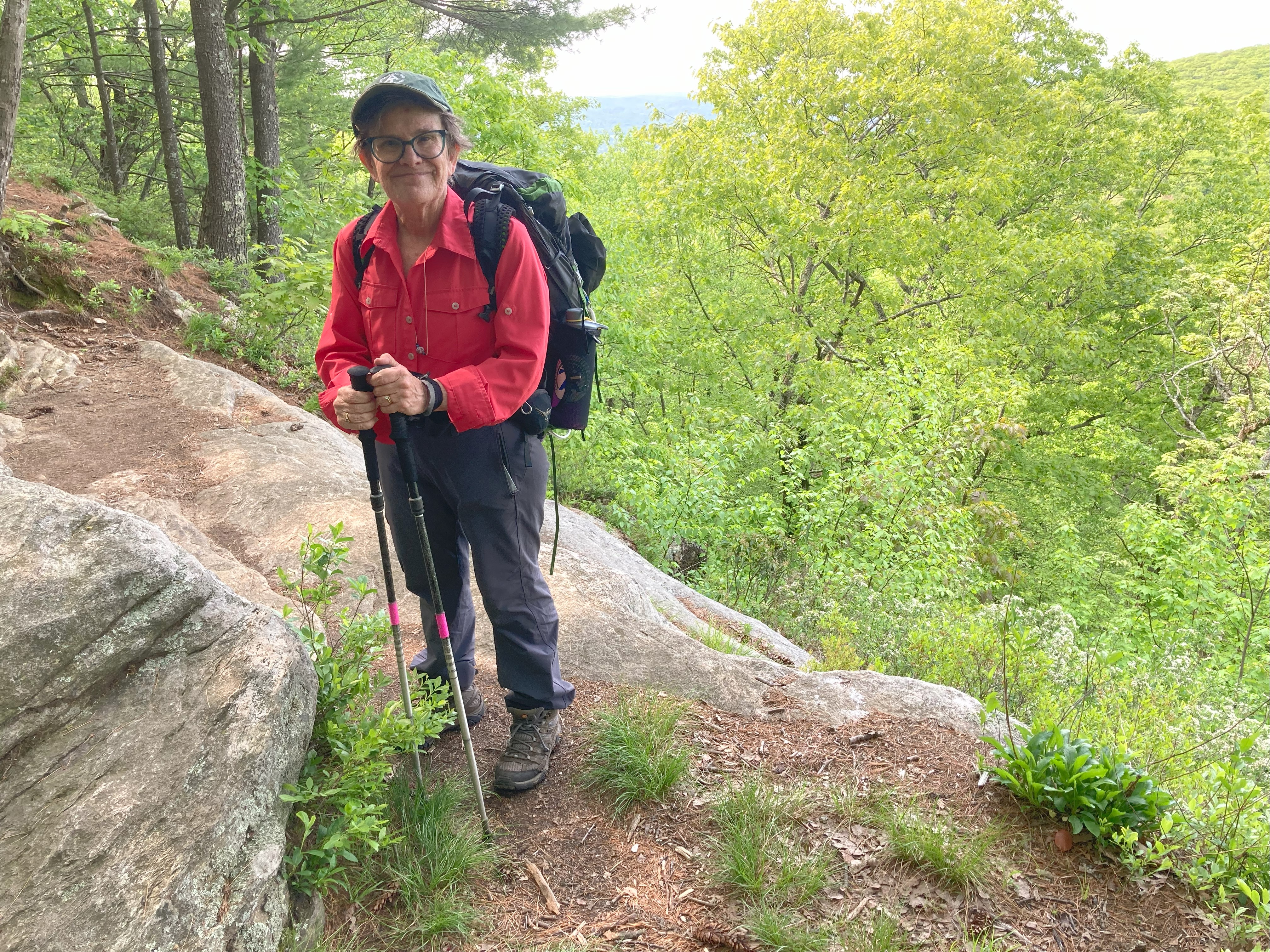
This morning, at 7:30, “Hudson” of Bearded Woods B&D—a two-time AT hiker and husband of Lu, who had shuttled us back in December 2021—picked us up at the AT parking lot on MA-23 and dropped us off on Water Street, in Falls Village. From there, we had mostly up hill to the top of Mt. Prospect, where we met Vince, a Connecticut trail runner for the Appalachian Mountain Club (AMC). He had spent the night at Limestone Spring Shelter and was now heading south. Maple and I pressed on, arriving at a meadow on the south side of US-44 at about 11:40. All day long, we had been hiking hard, with the promise of 2-3 inches of rain in the forecast. Now, with dark clouds overhead, I suggested that we stop and have lunch. About halfway up Lion’s Head, the rain began. It wouldn’t stop until the next morning.

Both Riga and Brassie Brook Shelters were torn down and not scheduled to be rebuilt until the end of June. There was no avoiding having to set up camp in the rain. Karen and I proceeded to Brassie, stopping at Ball Brook, .4 mile south, to fill up on water. I hadn’t bothered to put on my rain gear, because experience had taught me that rain gear only increased my propensity to perspire. When we stopped at Ball Brook, Maple and I were equally and completely drenched.
At Brassie Brook we scouted for a tent site that hadn’t already become a small pond, and when we found one, we erected the tent as quickly as we could. Even so, we were unable to prevent a quarter of an inch of rain from accumulating at the bottom. I completely stripped before climbing inside, in an effort to limit the amount of water getting inside. Still, Maple and I had to use our shammy to wring out as much as possible before laying out our gear. Needless to say, coffee and a warm dinner was out of the question. We snacked on a trail mix and hit the sack.
Day 2: Sun, 21 May 2023: Brassie Brook Campsite to Hemlock Shelter; 9.2 miles.
It rained on and off all night, but by the morning the sun was shining. Breakfast consisted of a ProMeal Bar and coffee. Birch and I began with a one-an-a half-mile climb up Bear Mountain. It was steep, but our legs were still fresh. The climb down Bear Mountain was more precarious, really more of a scramble than hike. At Sages Ravine we stopped at the first campsite, a gorgeous spot next to Sawmill Brook, for a second breakfast—oatmeal and coffee!

Then we walked along the brook, seeing incredibly beautiful waterfalls. It was magical! Before we knew it, we were at the Connecticut/Massachusetts border. We crossed the brook without any problem and began the ascent up Mount Race. This was a very long slog. The advantage was a remarkable view along the ledges. This is not for people afraid of heights! As we approached the top, dark clouds began to roll in and we were worried that it might rain again. (We were now wearing our only set of dry clothes.) Fortunately, the clouds passed.

Birch and I were, by this time exhausted, but we still had to descend this mountain and climb another. Toward the bottom, Birch took a huge spill, skinned his lower legs, and broke one of his trekking poles. We regrouped by having lunch before ascending Mount Everett. The mile-high climb was very steep and reminded me a bit of New Hampshire. Then, it felt like forever to descend to the shelter. Finally, we reached Hemlock Shelter, which is beautiful. We met “Rambler,” a thru-hiker, and Phil, who was section hiking with buddies. We hit the sack early.
Day 3: Mon, 22 May 2023: Hemlock Shelter to US-7; 8 miles.
I arose at 5:00 this morning to the sound of birdsong, retrieved our food bag from the bear box, took down the now-dry clothes from the line I had stretched, and made coffee before awaking Maple. It took her awhile to get moving, and I could see that she was still feeling beat, but we got onto the trail by 6:30.
Our plan had been to hike the 14.4 miles to Tom Leonard Shelter, and then, the following day, to hike the remaining 2 miles to our vehicle on MA-23. That way, we would have nearly the entire day to relax and recover. But circumstances did not cooperate with our plan. While hiking down Mount Everett, we missed the sharp turn of the AT and continued on the path down the mountainside, unaware that we were now on the Elbow Trail, heading down to MA-41. After not seeing a white blazing for awhile, I finally became concerned enough to check our gps. By this time, we had hiked about .3 mile downhill from the trail junction with the AT. All in all, our detour had cost us about half an hour. Then, we had to climb up Mount Bushnell, the peak of which we didn’t reach until 9:00—a full hour later than I had expected.

We were both very happy to reach Jug End Road, knowing that we had put the rockiest mountain range in Massachusetts behind us. But now we had to traverse fields and marshes, and the mosquitos attacked us in hordes, so we stopped to spray ourselves with Picaridin. The forecast was now calling for rain after 4:00. When Maple and I reached the Sheffield-Egremont Road, we took a snack break on the grass, next to a cable pole, and we came to an agreement. We would stop at US-7 and get a ride into Great Barrington.

Maple found a room available at the Holiday Inn. We then continued to US-7. On the side of the highway, Maple tried for an hour, without success, to book an Uber ride. We finally decided that we had to extend our thumbs. Within two minutes, a small car pulled over. Molly, a former nurse who had once lived on the Eastern Shore in Maryland but was now an octogenarian living in retirement outside of Great Barrington, was our very kind and pleasant trail angel.
After showering, Karen and I walked across the street from our hotel to the Barrington Brewery and had delicious hamburgers. Afterwards, we set up our wet tent in our room and, then, took a much-needed nap.
Day 4: Tues, 23 May 2023: US-7 to MA-23; 8.4 miles.
Birch and I had a nice breakfast at the hotel, and Raymond, our Puerto Rican Uber driver, picked us up at 7:15. He had driven one-and-a-half hours to drive us the five miles to the AT crossing. As he explained, there were no Uber drivers in Great Barrington.
Our first mile was through fields. Then we ascended about 500 feet. After taking a break, we continued the ups and downs. Although a few places were rocky, the trail was easy compared to what we had covered during the previous days. We made good time, arriving at the turn-off to the Tom Leonard Shelter by 11:30. We stopped there and had lunch. Afterwards, we enjoyed a comfortable descent to a large stream, which we crossed on rocks before ascending .4 to MA-23 and our vehicle.

From there, it took about 70 minutes to drive to North Adams. Birch called ahead to find out if our room could be available for us. Hotel Downstreet had just been renovated and was beautiful. It was so nice to relax with a cup of coffee in the lounge and read our books!
Day 5: Wed, 24 May 2023: MA-23 to Shaker Campsite; 9.3 miles.
Maple and I checked out of our hotel room shortly after 6:00 this morning and, half an hour later, were picked up by Bill Beattie at the AT long-term parking lot on MA-2 for our shuttle back to MA-23.
Basically, the whole day we were hiking up and over Wilcox Mountain. With a forecast of rain to begin at 1:00, we pushed ourselves, didn’t stop for lunch or snacks, and made it to the campsite still dry at 1:30. We quickly set up the tent, filtered our water from the nearby stream, and cooked our dinner before the rain began. We even had time to make ourselves coffee before retreating into our tent to listen to the rainfall.
Shortly after setting up camp, a flip-flop thru-hiker, a man about our own age, came into camp. He seemed quite disappointed to see that he was not alone. Maple, being the cheerful person that she is, welcomed him into camp. He mumbled something unintelligible in response as he walked past our tent. Later, while we were preparing dinner on the picnic table, he joined us. Trying to make conversation, I noted how the section from Lion’s Head to Jug End Road was the most difficult section of Connecticut and, so far, of Massachusetts. He replied, “I thought it was comparatively easy.” This rejoinder was so obviously b.s. that I wrote him off as unsociable and contrary and decided, then and there, to make no further attempt to engage him. Soon, Ann, another thru-hiker, came to the table, and we all introduced ourselves to one another, except “Grumpy” (as Maple dubbed him), who sat mute all the while.
Day 6: Thurs, 25 May 2023: Shaker Campsite to Birkshire Lakeside Lodge; 11.4 miles.
At 4:59 I heard Birch rustling around, clearly eager to start the day. Although it was likely about 37 degrees last night, I was still toasty warm. (Thank you, sleeping bag!) Getting out of “bed” is always hard on the trail, but Birch was like the Energizer bunny, and he motivated me.

After coffee and oatmeal, we packed up the tent and all our things and were on the trail by 6:15. “Grumpy” said nothing to us as we left camp.
Our first task of the day was climbing Tyringham Cobble, which had only modest views. However, it was nice to see a bench at the summit. At the bottom, we found a long boardwalk over marshland. After crossing a road, we checked FarOut and were very happy with our progress. We then ascended our largest mountain of the day—nameless! I suggested, “Maple’s Mountain,” but afterwards decided that the mountain wasn’t for me.

We stopped at Webster Road for a break and ate ProMeal Bars while basking in the beautiful warm sun. Back into the woods, we traveled over rock- and root-strewn terrain before the path finally became a little smoother. Lunch consisted of peanut butter and jelly on a tortilla.
Before long, we were traveling beside Upper Goose Pond, where we saw a stone chimney, the remains of an early twentieth-century clubhouse. We went up and over a small “Natural Area Boundary,” across I-90, and finally arrived at Berkshire Lakeside Lodge at around 1:45. The room was perfect! We ordered a very large pizza, salads, and cheesecake. The hiker hunger had definitely kicked in.

Day 7: Fri, 26 May 2023: Birkshire Lakeside Lodge to October Mountain Shelter; 7.4 miles.
After our huge meal last night (which, by the way, we couldn’t quite finish), Maple and I were ready to hit the sack early. She let me know that she wanted to sleep late in the morning, but I was up by 5:00 and in the lodge’s breakfast room, enjoying a tri-berry muffin and a cup of coffee.
The temperature had dropped into the lower 30s during the night, but surprisingly my hands were doing just fine. We were on the trail by 6:30, climbing Becket Mountain. Once on the top, we stayed on the ridge all morning, with plenty of little ups and downs. The highlight of the day was coming upon a mature porcupine walking along the trail. Maple stopped to take a picture, and then it waddled off into the woods.


In the morning, while enjoying my muffin, I noticed a brochure about Mount Greylock. While looking in over, I saw that there were four private rooms on the summit, in Bascom Lodge. On a whim, I called, but of course it was still too early for anyone to answer. Perhaps it was just as well, I thought. After all, what were the chances that there would be a room still available for Monday, Memorial Day. Even so, throughout the day, I kept trying, but was unable to get a cell signal. Finally, when we reached October Mountain Shelter, at about noon, I got through. I was told that the front desk clerk was out for the day, but she would be in tomorrow. But then, before he hung up, he added, “But I could check to see if there’s an opening?” . . . There was! He posted a note to hold the room for me, and then told me to call back tomorrow.
The tent spaces in front of the shelter were uneven and had either roots or rocks that made them less than ideal. Fortunately, Karen discovered a group tenting location behind the shelter that had several excellent spots. After we set up our camp, we sat on a log and ate lunch, then took a nap—which, as you may have noticed, is our favorite post-hike (in)activity—and then got up to filter our water from the nearby stream.
Later, while preparing our dinner at the picnic table in front of the shelter, two young thru-hikers came into camp, Chris (with a UK accent) and “Canary.” About half an hour later, we were joined by an older woman traveling SoBo, “Spam.” We were the only ones to pitch a tent.
Day 8: Sat, 27 May 2023: October Mountain Shelter to Kay Wood Shelter; 8.8 miles.
Overnight it got pretty cold, in the upper 30s. Still, we did really well. Birch and I got up and cooked oatmeal and coffee at our tent spot so that we wouldn’t awaken anyone. We left camp by 6:45 and experienced pretty easy terrain. As with other days, there were many bog boards over marsh and mud. I was beginning to think that this was a foretaste of Vermont. That said, this trail is very well maintained.
About at the halfway point, we arrived at Warner Hill, where we stopped for a snack and enjoyed the views. Birch was fairly confident that he could see Mt. Greylock in the horizon to the north. I couldn’t believe that; it appeared too far away. (We were later able to confirm that it was, in fact, Mt. Greylock that we saw.)

Although the second half of the day was a little rockier, we still made good time, making it to Kay Wood Shelter by 3:30. There were already two guys set up in the shelter, “Saw Dog,” who is an AMC trail runner, and a section hiker from Florida who was hoping to make it to Hanover before having to return home. The shelter was made in the usual Massachusetts style and looked very nice, but the best thing about Kay Wood is the great tent sites. We set up directly behind the shelter. FarOut said that the water source, Barton Brook, was “50 yards steeply downhill in front of the shelter.” Actually, it’s east of the shelter, and—to our relief—about half that distance away, only slightly downhill.
Day 9: Sun, 28 May 2023: Kay Wood Shelter to Father Tom’s Campsite; 11.9 miles.
I awoke at 4:00, got up, and made myself a cup of coffee. It was still very dark, but I could manage without a headlamp, and so I walked over to the picnic table and sat down with my coffee, taking in the gradual lightening of the horizon and the awakening of birds. Maple joined me at 5:00, and we were on the trail shortly after 6:00. The temperature was already in the upper 40s.
It must have been close to 8:00 when we reached the Juice N’ Java coffee and deli shop in Dalton. We had their delicious breakfast burritos, orange juice, and coffee, and purchased a sandwich to share later, for lunch, while on the trail.

Climbing Crystal Mountain wasn’t nearly as hard as I had expected. The trail brought us a lot of little ups and downs as we followed the ridge. We stopped for lunch on the tallest peak, just past Gore Pond. By that time, it was getting very warm and humid, and the temperature soon reached 84 degrees. When we finally made it to Furnace Hill Road, in Cheshire, we were spent. The heat had drained us of all energy. We reached Father Tom’s Campsite in town at about 2:30.

After setting up our tent, refilling our water bottles, and refreshing ourselves as much as we could, we walked over to Diane’s Twist, just around the corner, for milkshakes. The front door was locked, and there was no going inside. We were told by another customer that we had to go to one side of the building to place our order, and then to the other side of the building to pick up our order. There was no shade. Although there were two picnic tables on the lawn, neither had umbrellas. So, we had to sit in the sun while enjoying our very thin milkshakes. On our way back to our camp, Maple and I discussed strategies of improving Diane’s business.
After the day began to cool, we prepared our dinner at the table, where sat two hikers we had met at Kay Wood Shelter. As it turned it, we had set up our tent between theirs, in the only shaded area of the campsite. After dinner, although it was still light outside, we decided to retire, since we wanted to start early the next morning, hoping to avoid climbing Mt. Greylock during the warmest part of the day.
Day 10: Mon, 29 May 2023: Father Tom’s Campsite to Bascom Lodge, Mt. Greylock; 8.2 miles.

Birch and I were up this morning at 4:00, had coffee and oatmeal, and were on the trail at about 5:15. This morning was cool and crisp, very comfortable. After a short walk through town we entered a meadow from where we could see the summit of Mt. Greylock, then went back into a wooded area. The peak still looked very far away.

Although the elevation map on FarOut makes it seem like the ascent is very steep, this was true only in a few places. I was very thankful to have acquired trail legs that I could rely on. About midway up we found ourselves in a beautiful coniferous forest. Birch said that it reminded him of New Hampshire. The last mile up seemed to be the steepest. We crossed the road leading to the summit several times and watched cars zip up the mountain, while we continued to slog away.

By 11:00 we reached the lodge and, miraculously, our room was ready. We quickly jumped into the shower, put on our cleanest clothes, and were soon looking and smelling much better.
The afternoon was beautiful. After checking out the WWI monument in honor of Massachusetts fallen volunteers, we walked over the other side and saw paragliders launching off the cliff overlooking the town of Adams, and it was quite the thing to see. After watching for a while, we went back to the lodge for an early dinner of hamburgers and chips, then napped.

By 6:00 the summit had really cleared of visitors. There was only one other couple staying overnight in a private room. We were both feeling tired and excited about our hike down to our vehicle tomorrow.
Day 11: Tues, 30 May 2023: Bascom Lodge, Mt. Greylock, to MA-2, North Adams; 6.3 miles.
Maple and I rose early and debated whether we should wait around for the restaurant to open at 8:00. While we deliberated, we sat in the lounge, eating granola cereal with water. Finally, I admitted, “I don’t want to wait.” Maple agreed.
Although we only had 6.3 miles, mostly downhill, the hike wasn’t a cakewalk. First, precisely because it was downhill, we had to be especially careful not to allow our eagerness to overrule our caution. Second, our hike wasn’t all downhill. The descent from Mt. Greylock was broken up by two separate ascents, first up Mt. Williams, and then up Mt. Prospect. Even so, we arrived at the MA-2 parking lot before noon.

It had been a great vacation. The weather had, for the most part, cooperated with our itinerary, and the late-spring woods had been verdant and luxurious. We couldn’t have asked for better circumstances. And what is more important, we had completed our trip with only minor injuries, wounds that would soon heal and that were already nearly forgotten. Essentially, Massachusetts was now in the books. Only 4.1 miles separated us from the Vermont border, and those would have to wait until our return, some future summer, to hike through Vermont.


