Little Bennett Regional Park

Yes, we're the hikers!

Yes, we’re the hikers!

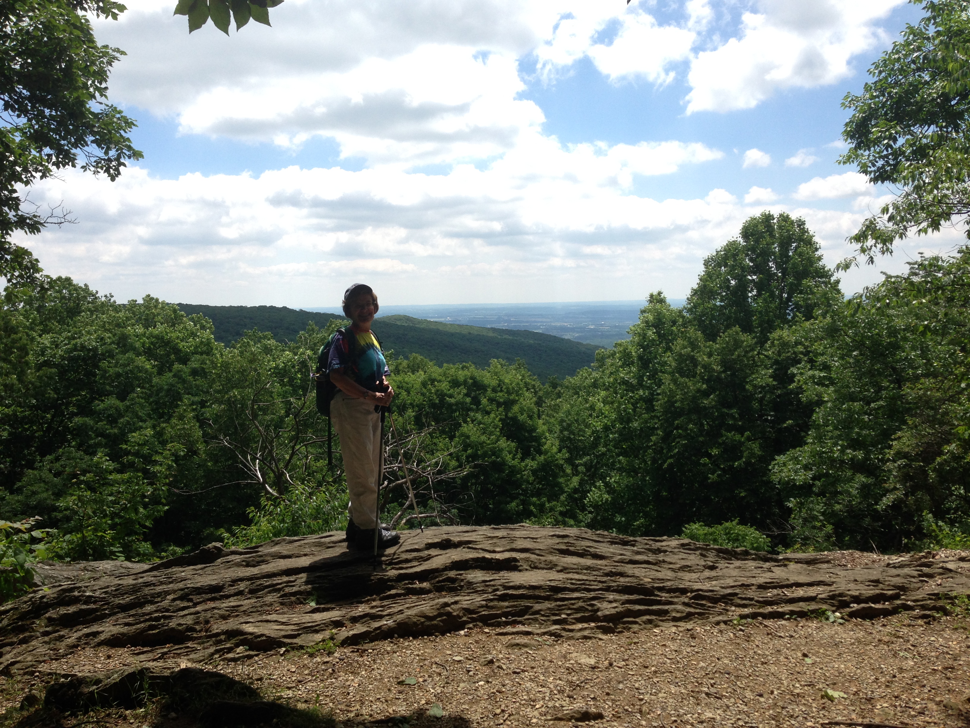
The Washington, DC area has a wealth of great hiking trails. Tod and I are learning just how lucky we are to have so many options close to home. Today we went to Little Bennett Regional Park, in Clarksburg, Maryland. This was our first visit, even though the park is about 15-20 minutes away from home.

The park has trails that snake around one another and intersect in some areas. Tod and I decided to start out from the Browning Run Parking Area and go west along the Browning Run Trail. As we went from a wild flower area into the forest we were met by a chorus of singing birds, all vying for our attention (or maybe the attention of their fellow birds!) The woods were beautiful. The trails are very smooth and easy to navigate, except for areas of mud. (These trails are probably not the best place to hike after a few days of rain.)

Except for a couple of bikers, a pair of horses, and a group of hikers, we had the trails to ourselves. We saw very few animals, with the exception of a very tiny (one inch) frog and a few tadpoles. My favorite part, as always, was crossing a creek.

Our hike included Browning Run Trail, northwest along Western Piedmont Trail, north along Pine Grove Trail, east along Timber Ridge Trail, continuing along Tobacco Barn Trail, then to Western Piedmont trail again (going southeast) to Kingsley Trail, to Purdum Trail and back to Browning Run Trail. As you can see, this is not the place to go for an easy circuit. While some of the trail intersections were very well marked, some places were not. We came to several forks in the trail and had to take an educated guess about what to do next. (Tip: download a map of the park and take it with you!)

Hmm....which way to go?

Hmm….which way to go?

The trails range from narrow, with thick vegetation, to meadows full of flowers (and bees), to park roads. There is a bit of everything here!

Although a little complicated to navigate, we really liked this park and will definitely be back again. Its a great place for folks who want to tailor their hike to a length that best meets their needs.IMG_2538

Sugarloaf Mtn. Revisited

This morning Karen and I hiked the Saddleback Horse (Yellow) Trail, the seven-mile loop around the base of Sugarloaf Mountain. The trail begins and ends at the farmhouse, near the entrance to the park. We pulled into the already-packed parking lot at around 9 a.m. and were lucky to find someone pulling out. It’s not nearly so difficult to find a parking spot inside the park, further up the mountain, in the lot at the head of the more popular Northern Peaks (Blue) Trail. The Yellow Trail would, perhaps, be as popular if the parking for it was more adequate. As it is, the Yellow Trail is serenely quiet, except for the singing of birds. During the three hours that we were on it, Karen and I met about half a dozen other hikers and crossed paths with one whitetail deer.

2014-06-22 10.14.112014-06-22 10.43.03

The trail is well marked, both with yellow blazes and with mileposts. The mileposts are marked 1 to 14, each signifying about half a mile. The trail begins and ends on pavement, but in between it is a dirt path, easy to moderate in difficulty, for the most part well worn. It crosses water at several places, but the creeks are narrow and shallow and well-placed rocks make them easy to traverse. The trail was often rather muddy; this is probably half due to the nearness of the creeks and half due to the rain that fell yesterday. Of course, at the end of the day, one can rinse off one’s boots.

2014-06-22 09.45.16

Oh, and did I mention that this is a horse trail?

2014-06-22 08.59.08

Well, as said, one can rinse off one’s boots.

As Karen and I approached the end of our journey, we came across a phantom hand showing us the direction of our path. We appreciate the help.

2014-06-22 11.25.00

We wanted to camp, but what about our dogs?

This weekend Tod and I not only hiked in Catoctin, but we camped too. We decided to camp the easy way, with our big tent and with plenty of supplies. A few weeks ago we camped without our dogs. Dash is a cavalier king charles spaniel and doesn’t have the stamina for a long hike. Mocha, a cocker spaniel, is both blind and deaf. Since Catoctin Mountain Park is only an hour from home, we thought we might pitch the tent after our hike, pick up the dogs from home, and have a pleasant evening of camping in the woods.

It turned out to be quite an experience. Dash was full of anxiety every time one of us left the camp site to use the restroom or get water. Mocha had an uncanny ability to get his leash tangled. Getting settled in the tent was pure chaos! Mocha paced around the tent and Dash followed. Finally, when we thought things had settled down we heard a dog barking outside. “Boy, that dog sounds a lot like Dash, ” I said. And where was he? Outside! We have no idea how he got out but he managed to wiggle out. Next, about two hours later, we noticed some animal pacing around the outside of our tent. Turns out it was Mocha! Needless to say, no one got any sleep.

Dash waits to go home while Tod makes coffee

Dash waits to go home while Tod makes coffee

In the morning, both dogs raced to the car the minute we let them out. I’m guessing we’ll go back to finding a dog sitter next time we hit the woods.


The Catoctin Mountain Park 2.0

On June 14 Tod and I decided to hike Catoctin Mountain Park again, this time doing a full loop of the trail. We started at the Visitor Center and took the 1.4 mile Falls Nature Trail to the falls.

The start of our hike

The start of our hike

Just a few weeks earlier this seemed like quite a hike. This time, however, I was really surprised by how quickly we made it to the Cunningham Falls. The Falls were thundering this time, thanks to several days of wet weather that preceded our visit. Lots of families were there, ignoring the signs that asked visitors to stay out of the falls.

From there we went up Hog Rock Nature Trail. Tod and I have new trekking poles and we were able to test them out as we climbed up the mountain to what was probably our highest point, at 1610 feet. Again, I really noticed how much easier it is for me to hike. Hardly the huffing and puffing that happened last time! Hog’s Rock was quiet, and we were able to sit on a rock and enjoy the view while we munched on a PB&J and some trail mix. Its not a very impressive spot, but its a nice place to break after the steep hike.

Hog Rock

Hog Rock

Tod goofing around with his new trekking poles.

Tod goofing around with his new trekking poles.

Onward we went, crossing over the Park Central Road and resuming the trail that took us past Thurmont Vista, Wolf Rock, and Chimney Rock. Each one of these spots were destination points for families, and so it was more crowded than the trails themselves.

One challenge this time was that many sections of the trails were like streams, with running water and areas that were muddy and messy. We made the mistake of taking the “short cut” to the Catoctin Mountain Park Headquarters. This section, just past Chimney Rock, was a drop of almost 600 feet in less than a mile. Yikes! Much of the trail was just like a river!

The last mile of the hike was going from the Catoctin Mountain Headquarters back to the Visitor’s Center. It is listed as a trail on the map but it was the least well-marked section of the trail. It was hard to follow and very rocky. We considered just walking along the road but we didn’t want to wimp out. In retrospect, the road looks like a better option.

Overall, the hike was about 9 miles and took about 5 hours. Coming back to Catoctin gave both of us the opportunity to measure our progress as hikers. We can attest to the fact that the more we hike, the better in shape we become. This is encouraging!

Karen- The official "tree hugger"

Karen- The official “tree hugger”

Along the Perimeter of the Green-belt

2014-06-08 09.46.33 It seems unlikely that one can make a circuit of 5.3 miles among trees and brush in Greenbelt, just off I-495, the Washington Beltway. Yet here, in Greenbelt Regional Park, Karen and I found this preserved spot of nature. The goldenrod-blazed Perimeter Trail makes its way, for the most part, within earshot of the freeway, among tall trees and adjacent to Still Creek and Deep Creek, which the trail crosses at several places by being carried above the eroded landscape on wooden bridges.

2014-06-08 11.42.412014-06-08 10.57.01

We had walked half a mile before I became aware of birdsong, so distracting was the steady roar coming from I-495. After the first couple of miles, however, the trail moves sufficiently far from the freeway to allow one to hear the sounds of insect life. We did not hear the snake that cautiously emerged onto the trail at our half-way point; in fact, we would not have noticed it had we not stopped within a few feet from its head to take a photo. There it was, and so we took its photo too.

2014-06-08 11.04.05

The Perimeter Trail offers an easy jaunt for families, but joggers appear to have all but claimed this path for themselves. A dozen passed us by. The path is well maintained. Short, two-person benches are placed at quarter-mile intervals, reminding one to break for moments along the way. Mileage markers also appear frequently. If one wishes to begin one’s trek at Mile 0.0, then begin where the trail is nearest to the park entrance. Park at the Sweetgum lot and walk across the park road to pick up the trail. You won’t need a map, but if you have one, it may ease your mind a bit when you come to places where the trail takes a turn at an intersection or crosses a road. Overall, though, the trail is easy enough to follow.

2014-06-08 10.20.12IMG_0333

Note: Dogs on leashes are permitted on this trail—but, beware of ticks! Karen and I both discovered ticks on ourselves after our hike.

Our First Glimpse of the Potomac Appalachian Trail

Our weekend of camping was topped off with a short (5-6 miles round trip) jaunt on the Appalachian Trail. As a new hiker, it felt a bit like we had hit the big leagues! We started the trail at around 8:30 am, near a bridge that connects the trail to Greenbrier State Park. From there, we went north and east, towards Annapolis Rocks.photo 4

The trail hugs the freeway for a few yards before climbing into the woods. The first mile or so of the hike was pretty much uphill, with some areas very steep. It wasn’t long before it leveled off and became less rocky. Compared to other trails, this one was about twice as wide and very smooth. It took us through a beautiful forest. Most of the hikers that we saw along the way looked pretty serious; they had backpacking equipment full to the brim with tents, sleeping bags, foam mattresses, and other equipment.

We passed one designated camping area and saw another one near Annapolis Rocks. They even had a latrine, although I was thinking that the woods looked a bit more inviting than walking into the old, weathered, structure. Annapolis Rocks is about 1/4 a mile down a side trail. It has an amazing panoramic view of the area. We could see the Greenbrier State Park, including the lake.

As the morning sun rose, so did the number of hikers. On our way back to the car we saw a lot more people, many with dogs. One thing I was surprised to see was a fox! It scurried across the path a few yards in front of us before slipping into the woods.

In all, it was a great hike. I can definitely see myself camping along the trail some day.photo 1photo 2photo 3

The Big Red Trail at Greenbrier State Park

Image

Having gotten up early at our Greenbrier campsite, Karen and I were eager to get started on our hike along the Big Red Trail. We brought along our map, but this proved entirely unnecessary, as the trails in Greenbrier are well marked; rarely is one forty feet beyond sight of a swatch.

We started on our hike at 8:45 and returned at 11:30, during which time we encountered three mountain-bikers, two joggers, and two fellow hikers—fewer people than one might expect, considering that the trail runs adjacent to the campgrounds. Just beyond the campgrounds, the Red and Orange trails skirt along the west of a small lake at which we saw a few men with their fishing lines in the water and one busy reeling in a catch. The forest bed aside the trail is covered, largely by leaves, fern, and fallen trees that lay moss-covered and rotting.

Image

Perhaps, one reason for the scarcity of travelers on this path is that the trail, measured at 4.5 miles, is said to be “difficult” by the Park Service. For the most part, it is no more difficult than the trail that Karen and I hiked at Catoctin Mountain Park. In fact, generally, the trail is smoother and less encumbered by rocks—which is not to say that the trail is rockless; it’s quite rocky in a few places. Moreover, although there are two or three stretches with breath-taking altitude changes, the change is never over three hundred feet in a stretch, and for the most part the trail moves along with a gentle undulation. In places, the trail might be more accurately said to be “easy.”

Image

The difficulty of the Big Red Trail is reached near the half-way point, when it crosses a creek. This point might be seen on the State Park map—which, by the way, is posted along the trail at every intersection, wherever one might be inclined to ask, “Now, which way?” Karen and I approached the creek walking westward, away from the lake. More often than not, rocks are strewn across the trail to keep it from becoming overworn and muddy, but we had reached a stretch in which the mud was unavoidable. Just past this stretch we reached the creek—ten feet across, with a current and depth that covered most of the rocks. Did we turn back? Did we retrace our steps to detour along the Blue Trail? Not at all. We steeled our nerves, removed our boots and socks, rolled up our pants to our knees, and negotiated the rocks as best we could. Trekking poles would have been useful in keeping balance. Even so, we met the challenge and soon placed it behind us!

Image

Don’t be discouraged by this obstacle! In hindsight, the problem of the creek made the hike more enjoyable and memorable. It distinguishes the Big Red Trail in my mind and makes me want to return—next time, bringing a hand towel.