Hoyt Road to CN-4

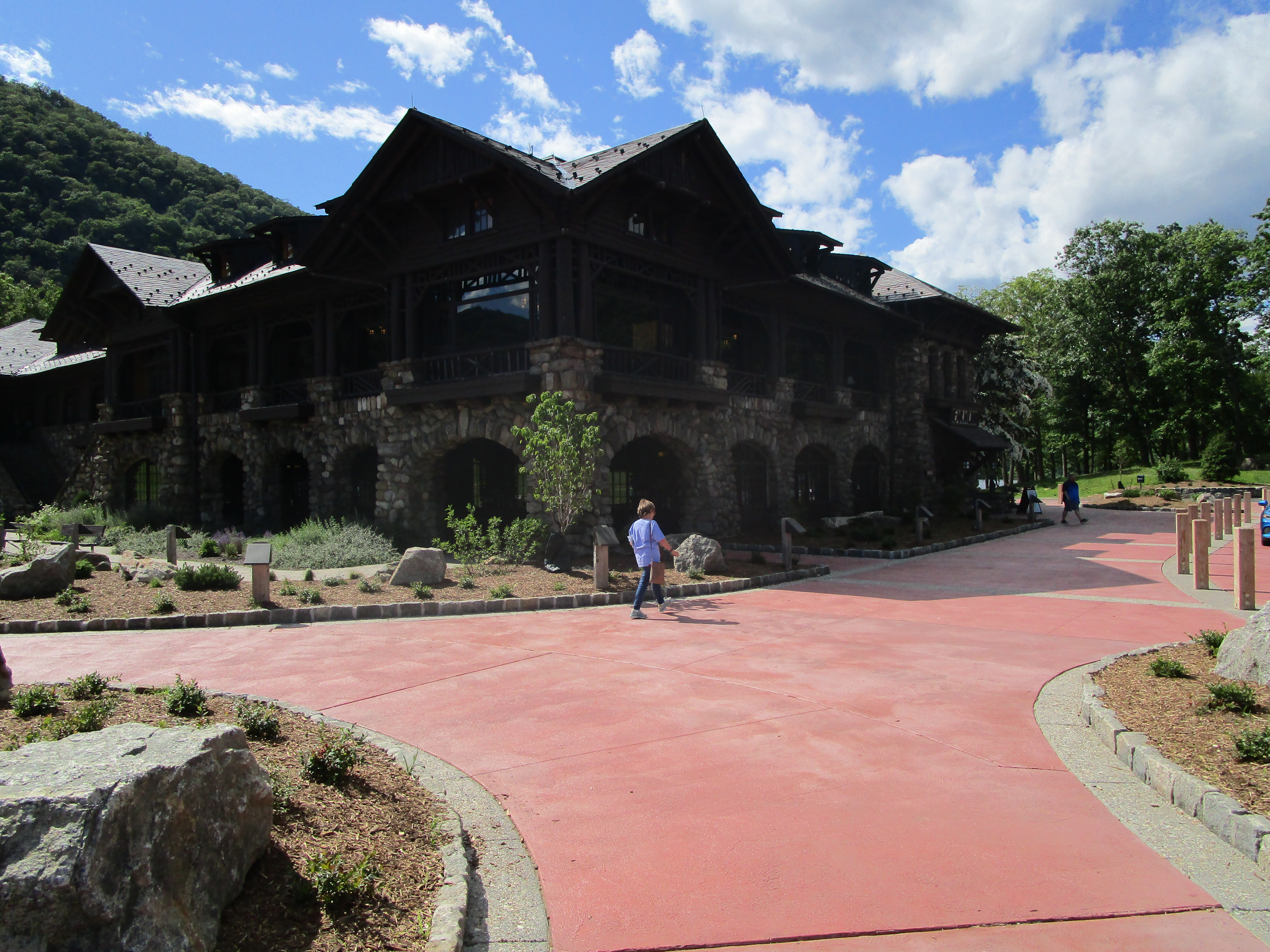
On Thursday night, October 3, 2019, Maple and I drove into New Milford, Connecticut, spent the night at the Rocky River Inn, and on the following morning drove north to Cornwall Bridge, where we hung out at the Country Store waiting for our taxi. The only shuttle we could find was the Pawling Taxi from New York. Our overworked driver got us to Hoyt Road, and we were on the trail by 9:20.

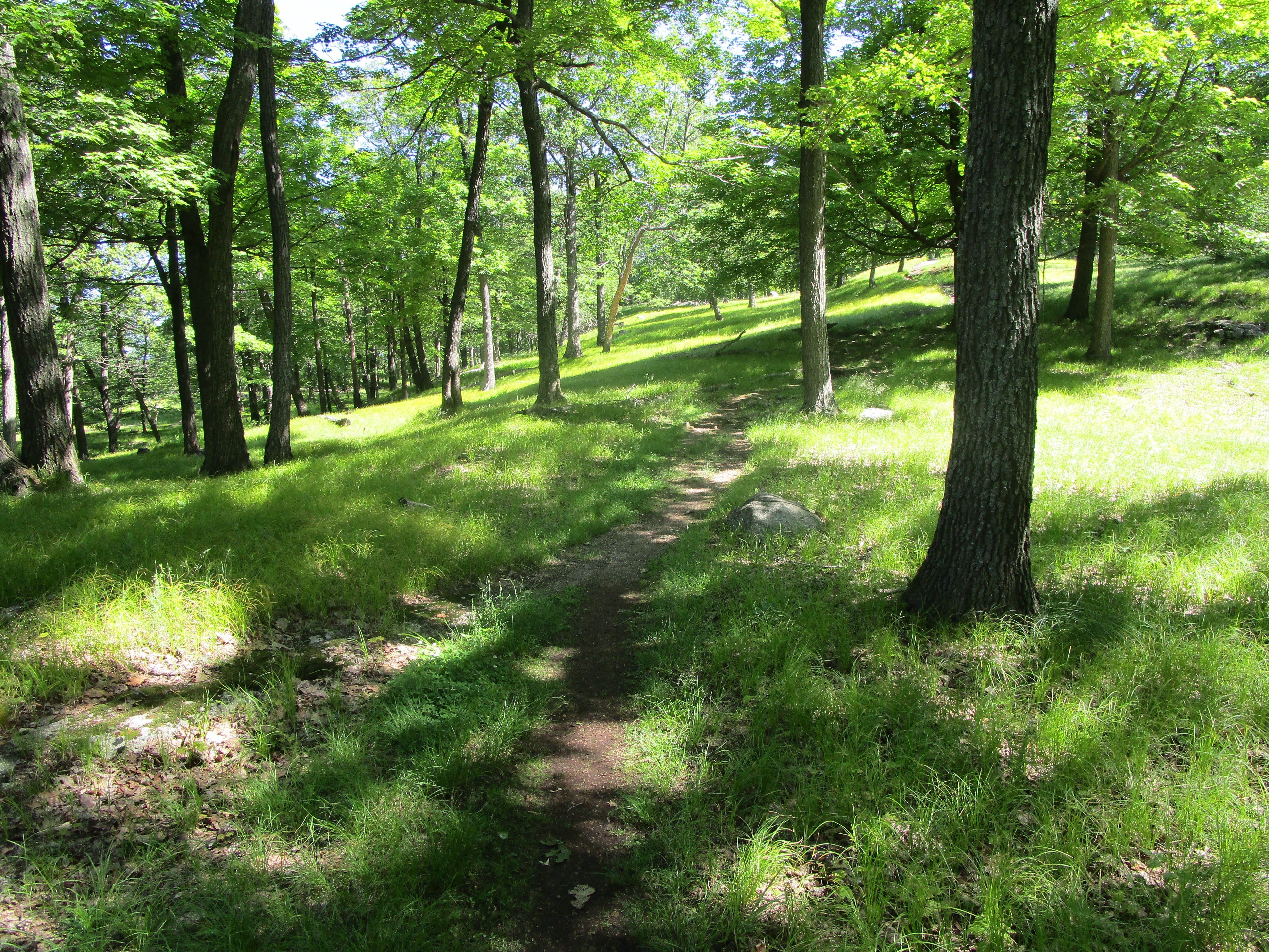
The rain of Thursday had been followed by a cold front, and the temperature had dropped a good twenty degrees. A chill was in the air, and it seemed that autumn had finally arrived. The leaves in Connecticut were changing color and were just beginning to fall from their trees. But we would have to watch out for the fallen acorns. Beware acorns! They are like marbles and will set your feet a-rolling out from underneath you. Karen and I were to slip numerous times during this trip, and Maple actually fell twice.

With just a few steps away from Hoyt Road, we were in Connecticut. We followed closely along the border until we got to Ten Mile River. Then, we followed the river north to its confluence with the much larger Housatonic. A bridge there allowed us to cross Ten Mile River and set us down on the southern bank of the Housatonic, which we walked along side of for about 1.5 miles, before coming to the border of Schaghticoke Reservation. This pushed us back toward and across the New York border, as we climbed our highest peak for this trip, Schaghticoke Mountain, a 1000-foot climb in three miles.

Maple and I hadn’t been exercising since our last AT outing, so by the time we reached Schaghticoke Mountain Campsite, at 8.3 miles, we were nearly exhausted. But it had been a particularly dry summer, and most of the water sources were dried up, including the source at the campsite. We pushed on. It was about this time that we ran into a flip-flop thru-hiker who was now SOBO, 140 miles from completing his trek. We wished him well, and inquired into the flow of Thayer Brook. One mile south of Mt. Algo Shelter, this brook was our last hope for water before making camp. We were assured that it was running, and indeed it was. Maple and I stopped there and filled up our dromedary.

It was 5:30 by the time we reached Mt. Algo Shelter. We were exhausted, but delighted to see that, although four tents were already up, there were still several tent sites available. By the time we set up camp and cooked our dinner, the light from the sky was quickly fading and the air was getting cold. During the night, the temperature would drop down into the mid-30s.

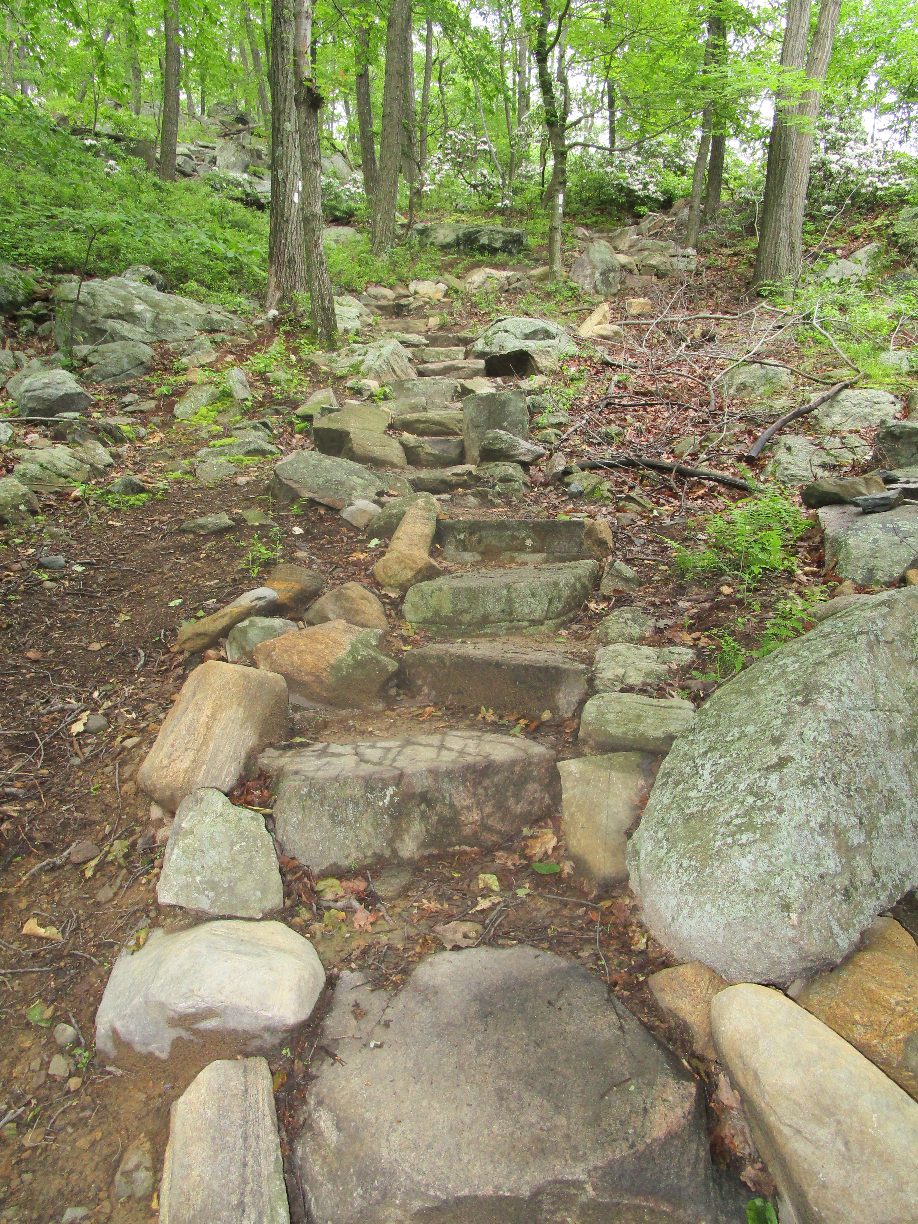
The reputation of St. John’s Ledges had preceded itself, and so, on Saturday, Maple and I measured our progress by how close we were getting to Caleb’s Peak and the beginning of this notoriously difficult descent. We arrived at about noon, and when we got there we found a group of day-hikers gathered at the top. They had just climbed up St. John’s Ledges, and part of the group had decided not to risk a descent. They were choosing rather to hike to the nearest road. The dubious consolation that the group included nurses and doctors was offered up as an incentive for them to make the descent, but they would have none of it. They were determined not to go back down.

Upon hearing this discussion, Maple and I both felt inclined to follow the cautious hikers to the road, two miles back. We walked up to what we presumed to be the beginning of the descent and looked down, and we could see neither path nor foothold. “How did you get up here?” I asked one of the group. “That’s the lookout, not the path. If you go that way, you are sure to hit hikers and climbers on your way down. The path is over this way.”

The path was, indeed, difficult, but at least it was not impossible. The key was to use hands and feet, and to keep three points of contact when descending step by step. It was more difficult than the Dragon’s Tooth, in Virginia, but not more so than certain parts of the White Mountains. Maple and I took our time, and before long we had completed the most treacherous section. Then, we came upon an REI-sponsored class of beginning mountain climbers, who were practicing on the sheer rock face of the mountain. One of them, a former thru-hiker, from back in the ’70s, talked with us briefly. It was clear that he had contracted a bit of nostalgia, for which there is no remedy but to get back on the trail.

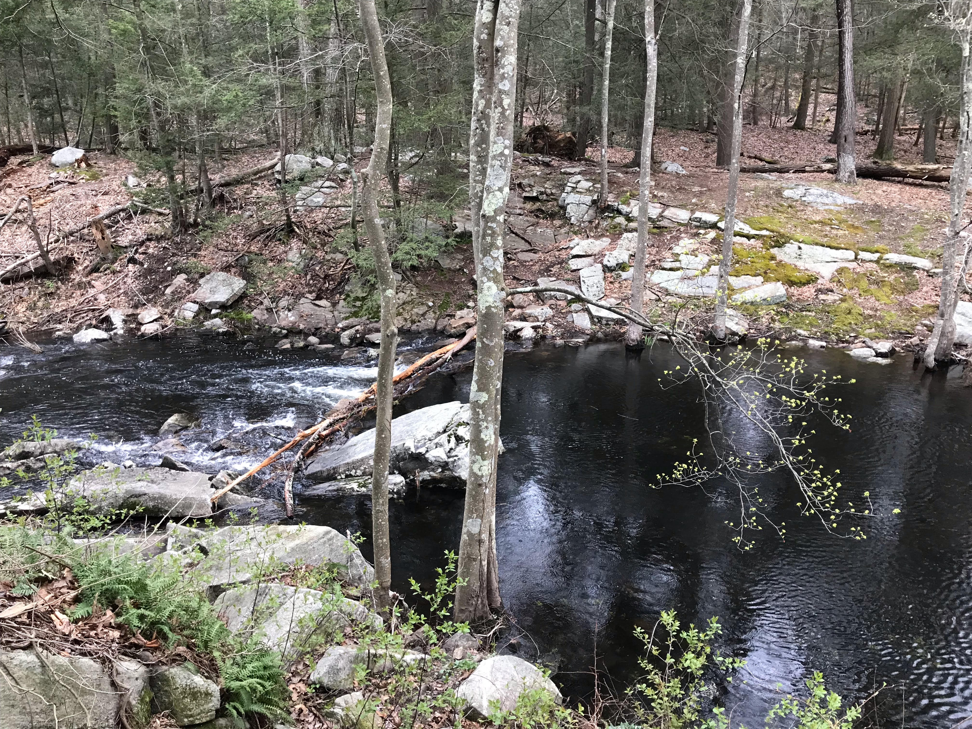
When we got to the bottom of the mountain, we found ourselves, once again, on the bank of the Housatonic River. We would follow this level path for three miles, passing by dry Stewart Hollow Brook Shelter. We stopped, instead, at Stony Brook, which had a decent flow and, up on the mountainside, several designated tent sites. All were unoccupied, and so we set up camp nearest to the brook and rested awhile before collecting our water for the night and next day.

On our final day, as we again walked along the southern edge of the Housatonic, we came across five white-tailed deer standing in the river. Upon seeing us, they darted across to the other side. Shortly thereafter, we came upon a couple of fly fishermen. The AT directed us away from the river and through a couple of open fields. Then, we had an 800-ft. ascent up Silver Hill. As we approached the top, the trail became increasingly rocky and even required a bit of scrambling. Fortunately, the way down, to CN-4 and our car, wasn’t quite so challenging.

Autumn in New England is lovely, and we shall soon forget neither this adventure nor its setting.

AT: NY-55 to Hoyt Rd.

Birch and I were excited to get back on the trail this Labor Day weekend. A trail volunteer named Donna picked us up at the Hoyt Rd. parking area and gave us a ride to the trailhead. While traveling, we learned that Donna is an amazing volunteer. She is someone who actually supervises volunteers and is active in the work of the Appalachian Trail Conservancy. She also volunteers for Hike for Mental Health (https://www.hikeformentalhealth.org).

The weather couldn’t have been better. It was cool (in the 70s) with just a hint of a breeze. The beautiful weather was matched by a beautiful woodland. The lack of elevations made for quick hiking, but we immediately noticed that water was going to be an issue. Each of the water sources that were marked on our map as being “plentiful” were, in fact, bone dry. Thus, when we found a low water source we took advantage of it and filled our dromedary, even though we were only a couple of miles into our hike. This proved to be a very good decision.

Birch and I approached this hike as a casual one so we built in plenty of time to just enjoy camping. We stopped at the Telephone Pioneers Shelter, just four miles into our hike. The hike to the shelter was super easy and included views of Nuclear Lake (that thankfully ISN’T contaminated with nuclear waste!).

For most of the day we had the shelter all to ourselves. We set up our tent, had a delicious hot lunch, read, and took an afternoon nap. How relaxing! Around dinner time, a couple came into camp carrying a regular-sized “car camping” tent, a small cooler, a large bag filled with bedding, and other assorted items. They had hiked up from the road, about 1.5 miles. Even though we had only hiked 4 miles they seemed impressed. I think we were impressed too, or perhaps shocked would be a better description.

The next day we got up early, despite the plan to have a leisurely day. (Birch doesn’t really know how to sleep in!) After having coffee and oatmeal we soon hit the trail. About .5 miles from the shelter was another “reliable” source of water that was dry. Thank goodness we had enough water!

The hike to our car was 10 miles. Within an hour we came across the famous “Dover Oak”, supposedly the oldest oak on the AT. It didn’t seem any bigger than the Keefer Oak in Virginia, but it was definitely huge. Because it was right by a road, we had no trouble finding someone to take our picture together.

Just before the 3-mile mark we emerged from the woods to a nature preserve and wetlands area. The cottontails were huge! We walked long the boardwalk and were glad that we didn’t have to hike through the swamp. At the 3-mile mark we reached the Appalachian Trail RR station. Just as we got there, an elderly woman named Jane arrived. Jane was wearing a beautiful pink gingham outfit with an AT volunteer shirt and cap. She came to meet the 9:20 am train and was carrying AT maps just in case anyone needed assistance. It really made me marvel at how people of all ages can play an important role in helping on the trail. (The NYNJTC has done a great job maintaining the trail, by the way.)

After leaving the train crossing we proceeded to cross a huge field until finally turning into the woods again. About halfway up a hill Birch realized that his favorite AT buff had fallen out of his pants pocket. Bummer! But when we stopped for water and a snack a couple hiked along and asked, “Did either of you loose a head scarf?” Yes! She had found it! We enjoyed a long chat with the couple who was from Pennsylvania and section hiking, like us. They had a HUGE dog with them (think 4 ft tall) and were looking forward to doing some hiking in Virginia later in the fall.

As Birch says, sometimes hikes feel they’re taking forever and drain you of every once of energy, and sometimes they sail by. This hike, we sailed. In fact, we completed the 10 miles in much better time than we completed the 7 mile hike a few weeks ago. Weather and no elevation changes made a big difference. With the next hike not scheduled until October, I’m hoping that cool weather will continue!

AT: NY-55 to Canopus Lake

This is the first time that Maple and I walked southbound north of Harper’s Ferry. The reason we chose to do this is the lack of parking at the trail junction on NY-55. We knew that there was plenty of parking by Conopus Lake, so that’s where we parked Saturday morning, August 17. From there we called an Uber, and we were picked up within 30 minutes. The driver, unfortunately, either had a terrible sense of direction or was unable to read his gps, so it took us an hour to get to our drop-off point in West Pawling. At 9:30, though, we were on the trail.

The first thing we noticed was the awful heat and humidity. Within 30 minutes we were soaked in our sweat, and we would remain soaking wet throughout the day. I suppose that thru-hikers can become somewhat acclimated to heat and humidity, but, together, they always take a heavy toll on Maple and me. As a result, these 12.4 miles to the RPH (Ralph’s Peak Hikers’) Cabin proved to be quite difficult—I think especially for me.
Three miles into our hike, we stopped at the Morgan Stewart Shelter to have a snack and to replenish our water at the hand-pumped well. Maple and I were carrying two liters each, but since we were sweating out every drop that we took in, there was no way that it was going to be sufficient to get us to the RPH Cabin.

8-17_11558-17_1326

One thing that certainly distinguished this section of trail is the prevalence of traffic noise. It seemed that we were almost always close to a major thoroughfare. In another 2 miles, we crossed over I-84, and for the next 3 miles, hiked parallel to it. Then, at Hosner Mountain, the trail turned so that it was adjacent to the Taconic State Parkway.

We stopped to eat our lunch on the trail steps off of Stormhill Mountain Road, just after crossing over I-84. The trail actually goes up this neighborhood road a little ways, and Maple and I wondered what the residents must think about all the hikers that walk down their road. It was so hot and humid that I lost most of my appetite, and could hardly manage half a sandwich. But, in another mile, at NY-52, we again stopped for a snack. Driving down NY-52 at the time was trail angel Bill, who stopped and offered to top off our water supply. Thank goodness! We needed every drop.

While hiking on top of the ridge of Hosner Mountain, we encountered several thru-hikers that were planning on getting to Katahdin before October. We wished them well, but privately wondered whether they would make it. Personally, I believe they should get to the Connecticut border, flip-flop, and then hike southward. However, I kept my opinions to myself.

Finally, we passed under the Taconic State Parkway and arrived at the RPH Cabin. We were utterly exhausted, and after setting up our tent, rested awhile. Then, we made dinner at the picnic table, pumped our water by the cabin, enjoyed a cup of coffee, and hit the sack. No sooner had we settled down, at about 9:00, than lightning and thunder announced the coming of a storm. Soon it hit, and it really poured. We felt a few drops pass through our tent, but no serious leaks.

8-18_0755

In the morning, we awoke to a day that was even more humid than the day before. We were the first up in camp and, after preparing breakfast and coffee, were on the trail by 8:00.

Sweat was soon pouring off of us, and by the time that we reached Long Hill Road, we had drank half of our water supply. To our good fortune, some anonymous trail angel had left gallons of water just off the road. Once again, thank goodness for the kindness of strangers! We drank up, filled up, and were on our way.

8-18_0920

After a couple more miles, we could hear people having fun at the beach of Canopus Lake. We had expected the trail to stretch out adjacent to the lake, but instead it remained on a very rocky ridge. The last two miles of our hike seemed to consist of a series of pointless ups and downs (or “puds”), but we finally arrived at a series of rock steps that brought us down from the ridge and, eventually, to our car. Maple cranked up the air conditioner, and in a few minutes we were on our way home.

8-18_09398-18_1040

AT: Bear Mountain State Park to Fahnestock State Park

This past weekend was a beautiful one for hiking! Bright blue skies without a hint of rain. Birch and I took an Uber from Canopus Lake to the Bear Mountain Inn and began hiking north by around 9 am. Unfortunately, the famous section of the AT through the zoo was not open, so we took the blue trail and crossed the bridge over the Hudson. After a short hike along NY-9D, we began our steepest ascent of the trip, up about 1000 ft to a peak known as “Anthony’s Nose” (supposedly named after a pre-revolutionary war sea captain).

Along the way, we ran into “Marmot”, a 70-year-old women who had thru hiked the AT about 30 years ago, and was now completing the north half of the trail, having done the south half last year. Marmot was enthusiastic and tenacious and was a great reminder that anything is possible.

Although the map shows many loop trails along the way, I really didn’t see them until we got to about 1 1/2 miles from the Graymoor Center. We crossed US 9 by a convenience store then quickly made our way to the Graymoor ballfield where we set up camp. The ballfield included plenty of picnic tables, water on tap, and even a shower. We settled in and relaxed, having the entire afternoon to read and enjoy the weather. Although we had heard that the center’s bells were loud, we actually enjoyed listening to them during the afternoon. We didn’t hear them at all at night.

In the morning, we awoke to quite a few more tents set up in the area. No one seemed particularly outgoing or friendly at 6 am so we quietly ate breakfast, broke camp, and got on the trail.

Our second day was much hotter than the first. Although there was not much elevation, we were sweating in no time.

The hike from the Graymoor to Canopus Lake felt like walking through a time machine. Old stone walls, the remnants of Revolutionary War era homesteads, seems to be everywhere. At one point we passed a plaque that marked where George Washington had inoculated troops against small pox. (Who knew that inoculations were possible then?!?)

It was at about this point that Birch and I hit a big milestone – our 1,000th mile on the AT! We were so excited! A hiker named “Digs” took our photo and gave us a fist bump, sending us on our way. We still needed to complete another 5 miles to get to our car.

We filled up with water at a pump station. The ascent to the Three Lakes Trail should have been super easy but the 90+ degree weather was a killer. We really had to take our time! The last two miles were very easy and we arrived at our car tired, but happy with our accomplishment.

AT: NY-17 to Bear Mountain Inn

Day One: NY-17 to William Brien Memorial Shelter

On Friday evening, June 14, Maple and I arrived at Bear Mountain Inn, on the west side of the Hudson River, New York. We were booked to stay in the Overlook Lodge. It’s a beautiful Inn, and our stay would have been perfect had it not been for a large group of boys who were loud until midnight. Still, the front desk clerk gave us a generous refund for the disturbance, so I really can’t complain.6-14_1553

Maple and I had a good breakfast at the 1915 Restaurant, and were, afterwards, picked up by Jossie’s Shuttle, and once again Richard, Jossie’s husband, was right on time. We were on the trail by 8:20 in the morning.

In about an hour we arrived at the “Lemon Squeezer,” where the AT passes through a narrow crevice between two boulders. Managing one’s backpack is the only real difficulty here. Almost anyone can skirt sideways and upward through the “Lemon Squeezer,” but if one has a large and heavy backpack, lifting it up sideways with one arm can prove challenging. The key is to get one’s backpack up onto the flat ledge above oneself as quickly as possible.

6-15_0924

The AT, as it traverses Harriman State Park, is not at all difficult. There is, however, a lot of flat rock, which may be slippery when wet. Maple and I saw a group of older ladies and a group of young girls hiking the path. Moreover, in mid-June, the Mountain Laurel is in bloom, and the fern is at its peak. It’s really quite a beautiful park.

6-15_0953

Our destination for the night, the William Brien Memorial Shelter, does not have a very appealing water source. The spring-fed well there is described by some as stagnant and covered with leaves. Therefore, Maple and I decided to fill up at the stream that is just before Seven Lakes Parkway, which feeds into Lake Nawahunta. There was a large rock in the middle of the stream, where we could sit and pump our water through the filter. We use the Katahdin Hiker Pro. Unfortunately, halfway through the process, the filter clogged, making the pump impossible to use. We spent an hour at the stream, attempting to unclog our filter. (This is the second or third time we’ve had this problem.) We were forced to accept the amount of water we had, though it required that we conserve.

We reached the shelter at about 3:00, set up camp, prepared ourselves a cup of coffee, and relaxed for awhile, prior to making dinner. The tent spaces at the shelter are nicely separated, and the area is quite beautiful. Maple and I enjoyed our stay here. We retired early, and slept well, but were awoken by the rain that fell at scattered intervals throughout the night.

Day Two: William Brien Memorial Shelter to Bear Mountain Inn.

Rain was forecast throughout the next day, but we were quite lucky. Although we had some sprinkles, it did not start raining in earnest until we were most of the way down Bear Mountain. Nevertheless, anticipating constant rain, but finding ourselves in a dry interval, Maple and I got up early and were on the trail by 6:45.

We had three mountains to traverse this day: Black Mountain, West Mountain, and Bear Mountain. It would be a day of significant ups and downs. The phenomenon that really made this day interesting was the rock stairs. I believe that these are created over billions of years, through processes of geological layering and erosion. Not only are they evidence of divine design, but they make hiking much easier. As Maple says, they are proof of God’s love for hikers and that he wants people to hike. We encountered rock stairs on all three mountains, but especially on Bear Mountain. Of course, I am aware of the argument that these stairs are of human design, but the incredible amount of physical exertion required to build such stairs is entirely foreign to human nature, which is fundamentally lazy; therefore, I stick to my belief.

6-16_0720

Maple and I got a good view of Perkins Memorial Tower from West Mountain. Maple said that it looked to be twenty miles away. Fortunately, it wasn’t. We arrived at the tower just before noon. This was Father’s Day, and the top of Bear Mountain, as well as the bottom (at Bear Mountain Inn) was crowded. From the top of Bear Mountain to the bottom the AT was graded and graveled, so it was really quite easy, though a little hard on the knees, going down.

6-16_1156

We arrived at the Inn soaking wet and thirsty, but after changing into dry clothes in the restrooms, Maple and I rehydrated ourselves at the Hiker’s Coffee Shop. We high-fived our backpacking success, and were soon on our way home.

AT: NY-17A to NY-17

After spending the night in a hotel in Secaucus, New Jersey, Maple and I made our way on Saturday morning, April 20, to the Elk Pen Hiker’s Lot on the outskirts of Harriman State Park, New York. The weather report had called for torrential rains, so we put on our rain gear and waited for Josie’s Shuttle. Soon, a man pulled up behind us, and announced that he was Josie. His voice didn’t match the Josie I had spoken with on the phone, but we got in anyway. His name turned out to be Richard, and he was a pleasant gentleman, who charged a very reasonable rate.

Richard dropped us off at NY-17A, and our hike began. Soon we reached the Pinnacles and, afterwards, Cat Rocks, both obstacles requiring scrambling over wet, slippery, and treacherous rocks. 4-20-1046Maple and I took our time, as we knew we had all day to make it to Wildcat Shelter. Still, I slipped and landed hard on my butt. We both crab walked more than once down moss-covered inclines. We could see the blue (safe) trail that skirted around the Pinnacles and Cat Rocks, but Maple and I are committed to the white blazes. Is that rational? Probably not, but it lets us say with pride that we are AT purists.

Soon after Cat Rocks, we made it to the shelter. After getting out of our wet clothes, we prepared our lunch, made ourselves coffee, and then, . . . when it looked like the rain would hold off a bit, we set up our tent and took a nap. When we arose, the tent was soaking wet, and several other hikers had showed up.

We introduced ourselves and found that one young man was a trail runner, who had covered over 40 miles that day northbound. That stretched my imagination to the breaking point, since the terrain he had covered was far from smooth. There were bogs to navigate, rocks to scramble over, and brooks to cross. Even so, I see that Jennifer Pharr Davis, according to her 2008 Itinerary, achieved the same mileage over this territory. I’m simply amazed!

We arose early the following morning, Easter Sunday, and were the first to depart from the shelter. Soon, we reached Fitzgerald Falls, paused to take photos of this beautiful area, and then proceeded, crossing the stream twice over rocks. During the first 5 miles we made great time, covering 2 miles per hour. But then we ran into a series of mountains, each requiring cautious scrambling.4-21_0841

To slow us down even further, biting gnats were out in force, not only biting, but flying into our mouths, our eyes, our noses, and our ears. When we needed most to concentrate on our footing, they seemed most bent on distracting us. It was maddening! Maple was attacked relentlessly, and after our hike needed medical attention for the swelling that ensued.

Just beyond East Mombasha Rd., there is a stream that runs into Little Dam Lake. When we reached it, I had a few choice words to express myself, for there was no bridge to cross or rocks to traverse. Maple and I had no choice but to ford it, and we could not see the bottom. Just then, it started raining again. I figured we would get soaked anyway, so we might as well go in with boots and pants. Maple practically dived in to the challenge. Before she was across, I followed. I’m 5’10”, and the water was just up a ways from my crotch. It was up to Maple’s waist. I forgot that I had our camera in my pants pocket. It was ruined, but fortunately the photo card was salvageable.4-21_1117

Just for the record, there is a beautiful camping area on the north side of this stream. Maple and I were exhausted at this point, but pressed on.

Our next obstacle was Arden Mountain, from the top of which we could clearly see NY-17 and the Elk Pen Hiker’s Lot. The descent from this mountain was more difficult and treacherous than the ascent. Still, we made it down safely and back to our car.

Altogether, this was one of the more difficult AT sections that we have hiked. It was quite an adventure!

AT: NJ 94 Vernon to NY 17a. Belvale, NY

This past weekend Birch and I went backpacking so that we could finish the New Jersey portion of the Appalachian Trail. Getting to NJ 94 wasn’t easy. There were very few shuttle options from our drop off point to the trail head. For this reason, we had to settle for a taxi service with a late pick up time.

IMG_0890

As we waited for the taxi the wind began to blow and the flurries began to fly. This was not going to be a warm weekend! The first part of the trail is known as the “stairway to heaven”. It is a short (1.4 mile) but steep ascent up Wawayanda Mountain that is fortunate to have many sets of stairs that make the hike interesting. There were a ton of day hikers who went up to enjoy the beautiful views. We, however, had mileage to make!

Unfortunately, our late start and the early sunset made it impossible to get to Wawayanda Shelter as we had hoped. Instead, we filled up with water at a stream just south of Barrett Road, crossed Barrett Road, made our way into the woods, and resigned ourselves to setting up camp. The sun was low, so we only had time for a cup of coffee and a cold sandwich before hitting the sack.

In the morning, we quickly made our way past Wawayanda Shelter and through a beautiful wooded area. After lunch, we began our climb up to the ridge. This included several places where I had to scramble and one area that had a very cool ladder that took us up to the ridge and across Prospect Rock to the highest point on the AT in New York. Again, we saw some day hikers who had come up to the area from a side trail. Once on the ridge we came to the New Jersey – New York state line. Another state complete!

This section of the New Jersey/ New York AT was surprisingly challenging. Although there is very little change in elevation, the ridge requires lots of short climbs, up and down, over a series of rocks. This slowed us down considerably! Another challenge was that the leaves had recently fallen on the trail, making following the trail very difficult at times. Thank goodness for the great job that the New York New Jersey Trail Conference did with its blazes. It saved us!

Instead of making up time from the previous day, we resigned ourselves to stopping short of the next shelter.  Given our time constraints, we agreed to end our hike at New York 17a the next day.  Weather throughout our trip was cold. After a warm dinner we tucked ourselves in for the night and when we awoke our water bottles were frozen. However, we had plenty of warm weather clothing, sleeping bag liners, and other gear that made us able to enjoy the trip despite the cool temps. The last day we had a very short hike to make it to our destination. Once off the ridge, the hike was very easy. We look forward to coming back when the weather warms up a bit.