AT: Pen Mar to Caledonia State Park

Maple and I had done this 19-mile hike once before, nearly five years ago. (See our earlier post on this site: https://weekendjots.com/2015/05/25/appalachian-trail-pen-mar-to-caledonia-state-park/.) We have been exercising at the gym six days a week, preparing for our big hike in New Hampshire this coming June and July. But the best preparation for backpacking is backpacking, so we decided to revisit southern Pennsylvania. We began at Pen Mar Park, in Maryland, just south of the Mason-Dixon line, and ended at PA-30, where the AT enters Caledonia State Park.

3-7_0900

Saturday morning began below freezing, and it would warm up only about 15 degrees during the day. We both started our hike wearing our fleece jackets, wool hats, and gloves. The sky, however, would clear up to a bright blue. The whole weekend would really be quite beautiful. Yet, we would see very few people on the trail.

We started our hike at 9:00 and arrived at Deer Lick Shelters at 11:30. There we had our lunch and rested awhile before continuing. Soon we were at Old Forge, close to where Antietam Shelter used to be, and in another mile we arrived at our camping location, Tumbling Run Shelters. The hike was very easy, mostly flat, and hardest in our first mile, coming out of Pen Mar, where one has to ascend a hill.

After enjoying a cup of coffee, we were greeted by caretakers Curt Finney and his wife, Tawnya. We had a nice discussion with them about the AT in New Hampshire. Once the sun set, the temperature quickly dropped, so after dinner we retired for the night. In the morning, I would find my dromedary half filled with ice.

3-7_1428

On Sunday, Maple’s birthday, our hike was somewhat more challenging, as we had several hills covered with boulders to make our way over. During this hike, we met Sean Sullivan, otherwise known as “Just Sean,” a thru-hiker who is attempting a calendar-year Triple Crown—that is, he is attempting to hike not only the AT, but also the PCT and CDT, in 2020.

With PA-30 (and the end of our hike) in view, Maple tripped over a tree stump on the trail and fell face first, breaking her glasses and blackening her right eye. It was an unfortunate ending to an otherwise wonderful trip.

3-8_1404

Appalachian Trail: Wind Gap to Delaware Water Gap

Having two cars, once again, Maple and I decided to complete our trek across Pennsylvania this weekend by backpacking north from Wind Gap, tenting at Kirkridge Shelter, and then crossing the Delaware Water Gap into New Jersey.

DSCN0451After climbing up the Kittatinny Mountain, which begins north-easterly of Wind Gap, we found ourselves back on the rock-strewn path that is so typical of the AT in Pennsylvania. This rocky path is without any distinctive landmark for seven miles, until one reaches Wolf Rocks, which is a ridge-line pile of boulders, across the top of which the AT stretches. This section is nearly as difficult and dangerous to cross as was the Knife Edge, which the AT traverses on its way toward Lehigh Gap. Between Wolf Rocks and Route 191 the trail is much improved, both smoother and wider.

Wolf Rocks

After crossing 191, where there is roadside parking, it is only half a mile to Kirkridge Shelter. Thus, although the shelter was deserted when Maple and I arrived, we figured we’d be having company, and even though rain was in the forecast, we decided to raise our tent outside, so we’d have privacy. Sure enough, it wasn’t long before a group of Boy Scouts arrived. They were so polite and gracious that we wouldn’t have minded if they had stayed, but there is very little tent space at Kirkridge Shelter, and after one of the leaders discovered the vacant lot of grass just north of the shelter, they packed up and set up their camp at this preferred location. We also had the pleasure of meeting two-time thru-hiker Nuthatch, who was on a day-hike with her canine companion, Mahoosuc, and decided to briefly stop by the shelter for the sake of memories. Ultimately, as things turned out, Maple and I had the shelter to ourselves throughout the night.

DSCN0456There is water seasonally at Kirkridge Shelter, potable water from a spigot, but the source is turned off during winter. Although it is early Spring, with temperatures now in the 70s, I decided it were best not to take chances, and so I packed 6 liters from Wind Gap. It was a good thing I did! There is still no water between Wind Gap and Caledonia Creek, at the bottom of Mount Minsi.

It rained during the night and nearly all morning. Fortunately, the weather cooled considerably, so in the morning Maple and I were not uncomfortable hiking in our rain jackets. We were back on the rock-strewn path until we reached Totts Gap, two miles north-east of the shelter. Between there and Mount Minsi, the AT follows a service road that makes for easy hiking.

View of the Delaware River from Mount Minsi

View of the Delaware River from Mount Minsi

The descent from Mount Minsi is steep, and one has to use large rocks as stepping stones. In the rain, these were slick, and though I tried to be as careful as I could, making use of my trekking poles for balance, I nevertheless slipped and came down on my hip. It was like slipping on ice and falling on concrete. I’m not sure whether my backpack made my fall harder or lessened the impact, but I soon was on my feet again, little worse for the wear. The occasional fall is just part of the price one pays for the pleasure of backpacking.

DSCN0459DSCN0462

By the time we reached the community of Delaware Water Gap, on the western side of the bridge crossing the Delaware River, the rain had stopped and the sky was rapidly clearing. We had another mile to go before we, finally, crossed the bridge and arrived at the parking lot at Dunnfield Creek in New Jersey.


Appalachian Trail: Lehigh Gap to Wind Gap

Tod and I are chomping at the bit to get the Pennsylvania sections of the AT completed. Thus, it may not surprise you to hear that we did three days of hiking in the middle of January. Weather was iffy and we agreed not to hike or backpack in dangerous conditions. However, the forecast brightened and we were off!

The first day was a 5+ mile hike from Lehigh Gap to Little Gap. If you’ve ever read a thru-hiker’s book, they almost always seem to have a picture from the top of Lehigh Gap to illustrate the beauty – and rigor – of the hike. The trail quickly comes to a vertical 1000 foot “hike” that is really rock climbing. As we approached the foot of the trail someone coming from the opposite direction said, “It’s windy up there!” Boy, was she right.IMG_0182

I’m a wimp when it comes to climbing. It helped to focus on putting one foot in front of the other, moving my hand to the next best rock. I didn’t spend much time looking down.  I was able to conquer fear and make it to the top. I would have jumped up and down with my hands in the air like Rocky Balboa had it not been for the fact that the top was just as rocky as the face of the cliff. Tod was very supportive as I growled and groaned. I have no idea how solo hikers do it.

The rest of the hike was through a section of the AT that is diverted onto a grassy trail designed to try to avoid a superfund clean up site. I know. It doesn’t sound pretty and it really wasn’t. One quirky thing about this area is that the blazes were, well, interesting. There were lots of double blazes in areas where there was no change in trail direction. IMG_0185Near the power lines we saw some huge, footlong, super wide blazes along the rocks. On a positive note, this part of the trail was really easy and it wasn’t long before we were at Little Gap.

We stayed overnight in a hotel and were back on the trail the next day by 8:15 am. The weather looked good and we were looking forward to a night camping at a shelter. The hike began in a pretty swampy area, but we quickly made it to the top of the ridge. Imagine what a surprise I had when I looked to my left, only to see people skiing a few yards away! (This isn’t something that most thru hikers would see.) I guess the Appalachian Trail goes right by Blue Mountain resort. I felt some kinship with the skiers since they also like to be outdoors in the winter.

We stopped to make lunch at 11:30 am and by 1 pm we had gone at least 8 miles. Then, it started to snow. This wasn’t expected and made things a bit slippery. Had we not been so tired, and had it not been winter, we probably would have gone the whole way to Wind Gap (about seven additional miles), avoiding a night outdoors. Instead, we tried to make the best of the situation by arriving at Leroy Smith Shelter and setting our tent up inside the shelter.IMG_0179

My favorite part of the trip was hanging out at the shelter, drinking coffee, and watching the snow. Everything was silent. Peaceful. It was really beautiful. Tod and I made dinner and were in the tent ready to sleep by 7:15 pm. Even though it was well below freezing I was warm. By the time we got up in the morning it was 11 degrees, not including windchill. Our stove/fuel had frozen, and making breakfast was not possible.

The rest of the trip was a bit like being in survival mode. Packing things up in the cold was not easy. Most importantly, Tod’s fingers were in a lot of pain. (Tod has lived in Alaska and his fingers have had frostbite.) Luckily, the hike to Wind Gap had several things going for it: beautiful views, bright sunny weather, few inclines and manageable rocks. In no time, we arrived at Hahn’s Lookout. We quickly made our way down to the Gap and to our car.

IMG_0180_2I’m pretty proud of us for doing so well hiking in adverse conditions. Part of the fun of hiking and backpacking is testing yourself and being successful. Certainly, proper clothing and equipment is key. I had five layers on and was toasty warm. In the future, we won’t forget to bring the cooking equipment into the tent with us when we  go to sleep so that it stays warm.

Next time? New Jersey, here we come!

IMG_0188


Welcoming the New Year on the Appalachian Trail: Port Clinton to PA 309

Day One: Port Clinton to Windsor Furnace Shelter

Regardless of freezing temperatures, Karen and I decided to close the old and bring in the new year, 2016, on the Appalachian Trail. We returned to Port Clinton and parked off ofDSCN0248 Broad Street. There we picked up the trail, passed under highway 61, and clambered up Blue Mountain once again. On top of the ridge, we had the usual rocky path before us and no noteworthy obstacles. The trail does descend to Pocohontas Campsite and Spring only to reascend shortly thereafter—a rather pointless down and up for us. Again, the trail descends a bit to Minnehana Spring. Both springs are on the KTA map, and both are active, though Pocohontas is the better of the two for gathering water. What is not on the map is a rapidly flowing creek between Minnehana Spring and Furnace Creek, above Hamburg Reservoir. Had we urgently needed water, this would have been the best source yet. See the photo below.

DSCN0251
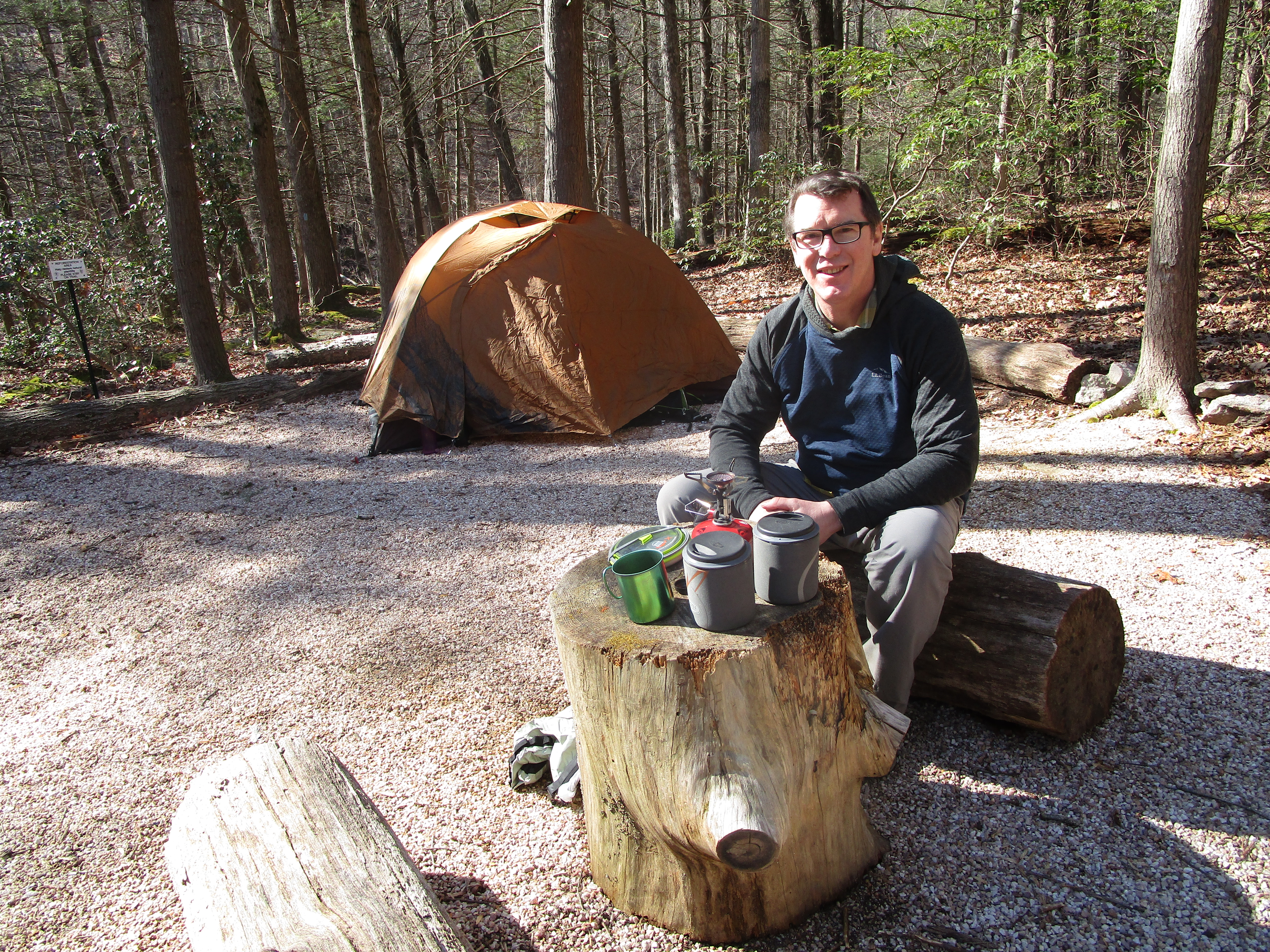
It was late in the afternoon when we arrived at Windsor Furnace Shelter, and having the place to ourselves, we decided to lay out our sleeping bags within the shelter itself. This is the first time that we didn’t pitch our tent. Soon the frigid weather made itself felt, and so we quickly slipped into our long underwear and winter clothing. Hardly had we done so when we got two visitors, Mike and his son Wyatt. They were going to set up their tent further down the trail, but first stopped to introduce themselves. Later, after the sun had set, they again came by for some New Year’s Eve fellowship. From the sixteen-year-old Wyatt I learned, “There is no such thing as bad weather, only bad gear.”

DSCN0253

Day Two: Windsor Furnace Shelter to Eckville Shelter

Karen and I stayed toasty warm in our sleeping bags and liners. In fact, so comfortable were we, buried in the darkness of our bags, that we failed to notice the morning light and didn’t arise until 8:30. Within an hour, we were back on the trail.

As we scrambled up and over the boulders at Pulpit Rock, Mike and Wyatt caught up with us. This was as far as they were going. They were the first to whom we wished a happyDSCN0258 New Year. Karen and I paused to take a picture of ourselves before the overlook and, then, quickly got on our way. Soon we arrived at the Pinnacle, and as we arrived the temperature suddenly dropped and snow flurries started to fall. A dozen or so day-hikers arrived just behind us. We carefully found our way across the rocks to the overlook, took in the view, but didn’t stay to fully appreciate the spectacle. A frigid breeze and darkening clouds prompted us to be on our way.

DSCN0259

From the Pinnacle to Eckville is the easiest AT in PA. The path is, until perhaps a mile from Eckville, broad and relatively flat and smooth. The only drawback is that the trail is wet and muddy up until it reaches a junction with the blue trail favored by day-hikers. Although the map doesn’t show it, the trail crosses Pine Creek over a bridge, and shortly thereafter it darts back into the woods. It emerges at Hawk Mountain Road. Pine CreekThere is no sign to indicate that Eckville Shelter is just down the road a ways. Karen and I, expecting a sign and a blue trail to lead us to the shelter, continued to hike another half a mile before we came to the conclusion that we must have missed it. Retracing our steps was a hard thing to do, especially at the end of the day, and on our way back to Hawk Mountain Road, we picked out a spot to set up our tent should we fail to find the shelter. Yet, find it we did. There was a hardly noticeable blue blaze down the road, pointing us in the direction of a white house, behind which is the shelter.

DSCN0263

We were Eckville Shelter’s first occupants of 2016. The place had been winterized, so there was no electricity and the privy was closed, but the spigot coming from the house provided us with water, and the four walls kept us out of the wind. The place has two sets of bunk beds on one side, and another set and a table on the other side. Soon after setting ourselves up, and while we were preparing our dinner on the picnic table outside, the associate caretaker and ridge-runner, Scott B., appeared. We thanked him for his hospitality, and he shared with us some of the history of the local trail. Shortly after the sun had set, we gladly slipped back into the warmth of our sleeping bags.

Day Three: Eckville Shelter to PA 309

Saturday morning we arose at 7:00, after another twelve-hours’ sleep. The temperature had dropped into the 20s over night, and the sun had yet to make itself felt. After a breakfast of hot oatmeal, we donned our packs and hit the trail. Ahead of us was our highest ascent of this trip, again up Blue Mountain. Once upon the ridge, the trail became rockier than we had experienced during the first two days. We scrambled up Dan’s Pulpit and, then again, we scrambled across the Balanced Rocks.

DSCN0267

After five-and-a-half hours of hiking, we finally reached Allentown Shelter. This is a much nicer shelter than Windsor Furnace. It is set higher off the ground, and has a bunk platform on each side of the interior, and a table built into the two sides of the exterior. We made ourselves a hot lunch and basked for a few minutes in the near 40-degree warmth of the sun.

DSCN0268

From Allentown Shelter, the northbound trail follows, for about two miles, an old, abandoned dirt road, which allows for faster and less treacherous walking. By this time, the bottoms of my feet ached from the constant pressure of rock edges, so I was ready for this change. So, too, was Karen, whose back was now aching. In an hour and twenty minutes, we covered the last four miles to PA 309.

It had been a delightful and memorable adventure. What a great way to begin the new year!


Appalachian Trail: PA Rt 309 to Lehigh River

Last year Tod and I ended our backpacking long before December. What a mistake! We are determined to stay in shape, be active, and complete the PA section of the AT. Even though the weather forecast predicted some chilly weather, we decided to do what seemed to be a pretty easy 13+ miles.

The parking lot at our starting point was full of pick up trucks. PA is still in the height of deer hunting season and we did not come prepared with our orange vests. We met a couple who was also planning to backpack overnight and we learned that they had more folks joining them. This sounded great. We would not be alone at the shelter! We took off while they waited for the rest of their party to arrive.

At first it was smooth and easy. I thought for sure we’d get into camp early. About two miles into the hike we came across our first boulder field. From here, it was rocky all the way. The highlight of the hike (if one can really call it that) was an unnerving section called “knife’s edge”. Up we went, to a pointed, jagged, mountain of rocks! This is not the best place for those who have vertigo or who need assurance of firm footing. At one point Tod said, “I can’t watch!” as I practiced my best balance beam approach to navigating the rocks.DSCN0209DSCN0211


Once at Bake Oven Knob Shelter (maintained by the Blue Mountain Eagle Climbing Club)  we were surprised to see the couple who we had left in the parking lot. How did that happen? The group (wisely!) decided to start from another, closer, location. The family, headed by Kevin and Linda, included 3 adult couples as well as an adorable dog. What a fun group! They made an enormous fire and generously invited us to warm up.

Tod and I were well prepared. We had a very comfortable night and kept warm. When we awoke we were a little surprised to see everything (including our tent and backpacks) covered in frost! I have to admit, I was a bit proud of myself for weathering the elements so well.

My frosty pack!

My frosty pack!

We had hoped that the next day of our hike would be less rocky but it didn’t really turn out that way. We still encountered boulder fields. However, the views were stunning and well worth the effort. There are plenty of fantastic places to camp should you decide that the shelter isn’t for you.

We kept expecting to run into the PA Turnpike but we didn’t do so. It turns out that the turnpike runs underneath the mountain! (I wish the map had mentioned that.) After a rocky, careful downhill trek, we arrived at the bridge over the Lehigh River. What a great way to spend a weekend!DSCN0228


Appalachian Trail: Swatara Gap to PA 183

Trying to NOT look like deer!

Trying to NOT look like deer!

Day One: Swatara Gap to PA 501.

Early Saturday morning Tod and I left home for the two and a half hour trip to Swatara Gap. The route is very familiar to us now. We know Route 15 like the back of our hand.

We arrived and dropped our second car off at 501 and arrived at Swatara Gap by 9:15 am. The good news? One parking spot left! The bad news? Hunters had gutted a deer and left the carcus right at the front of this spot.  The stench was horrible! We tried to get our gear ready and be on the trail in 30 seconds  — without breathing. It had to be a record!

The Appalachian Trail Conservancy website states “The A.T. passes through game lands managed for hunting, so fall is not the best time to go.”

Did we let the fact that hunters might confuse us for a deer bother us? Of course not! Off we went into the woods. In the two weeks since we were here, the leaves have really turned in color. The crisp fall day was perfect for a hike. As usual, we ascended onto a ridge, this time onto Blue Mountain. The ridge was very narrow and we were able to look down on both sides of the mountain. Very cool!

What wasn’t so cool was the rocky path before us. It is hard to follow white blazes when you have to constantly look down to watch your feet. At one point I marched us right off the trail. Thankfully, Tod was able to figure out how to get us back on track.

Eventually, the narrow ridge widens. The noise of the highway traffic ebbs, and the serenity

William Penn Shelter

William Penn Shelter

of the woods rules. We arrived at William Penn Shelter. It is a really amazing structure with a neat loft that is perfect for a stormy night. Tod turned on our stove to make “coffee” and I soon learned he had a surprise for me. Pumpkin spiced latte! Really?!?! How awesome!

As new hikers arrived they all marveled at the incredible smell of our drink. “Butter” and his son and others were there to stay the night but we pressed on. Oh, the joy! From here, the trail was REALLY easy. About a mile before 501 is a really nice camping spot with nice views. From there, it becomes rocky again. We encountered several families out for the day to take in the incredible views. 501 has quite a bit of parking but it fills up quickly and the place was quite busy when we arrived at our destination.

Beautiful views!

Beautiful views!

Day Two: PA 501 to PA 183.

Sunday morning, after a pleasant evening in our comfortable motel room, Karen and I set out to drop off our destination car at the Game Lands Commission gravel parking lot near the ridge on PA 183. Here, we found lots of room for parking. Then, we headed toward our starting point on PA 501, a gravel lot just off the road.

This autumn day was beautiful, the sky was deep blue, and the morning air was crisp. We were about a mile and a half into our hike when we met a southbound couple. They introduced themselves to us as “Chief” (a retired chief of police) and “Toad,” and told us that, at PA 501, they would be completing their flip-flop, thru hike of six months. I hardly knew what to say, other than “Congratulations!” How does one rightly acknowledge and participate in such a momentous occasion? Anyway, they seemed like a very nice couple, and we wish them many more happy trails.

According to the KTA map, we would reach the ominous sounding “Boulder Field” just before the Hartlein campsite. Karen and I tried to psychologically prepare ourselves for this challenge. Already the trail was extremely rocky, and before long it demanded carefully stepping from one huge rock to another. Our ankles certainly were getting a workout. What in the world, we wondered, would “Boulder Field” be like? Well, eventually the trail began to become more manageable, and then we suddenly found ourselves at the Hartlein campsite, where a sign notified us that we were leaving “Boulder Field.” It was only then that we realized that we had already put the notorious section behind us. Contrary to the map, “Boulder Field” is not just south of the campsite, but is about halfway between the campsite and PA 501.

IMG_0537IMG_0538

We rested at the Hartlein campsite, on a log before a fire pit, under the shade of tall trees, with a bubbling brook to our right and a meandering creek to our left. Here we had our lunch and coffee break, during which we had the good fortune to meet “El Sol,” a hiker from New Jersey not far into his journey to reach family in Georgia. “El Sol” had pledged himself to bring warmth and light to everyone he encounters on his way, and so we were pleased to make his acquaintance.

IMG_0541

The Hartlein campsite was both the high point and the turning point on our day’s journey. Before it, one could hardly find a few inches of flat earth to rest one’s foot upon, so covered it was with rocks. After it, it wasn’t unusual to find small stretches upon which one could take a half dozen consecutive steps on flat earth. In other words, the journey to our destination became much easier north of the campsite.

Karen and I felt that we had reached our destination when we came upon PA 183, but we still had another half mile to go, since we were headed toward the gravel road that would connect us to the Game Lands Commission parking lot. The extra half mile was worth the security of having our car further off the road.

Appalachian Trail: PA-325 (Clark’s Creek) to Swatara Gap

Yesterday morning Karen and I crossed over beautiful Clark’s Creek, a popular fly-fishing creek in this area, and began our two-day, 15.9 mile hike to Swatara Gap. The hike up Stoney Mountain was long but gradual, never steep, and with no switchbacks. The mountain lived up to its name; it was, indeed, stoney, but required no scrambling up and over boulders. Karen and I were surprised to see so many rhododendrons growing by the trail at many places. The early autumn season was evident in the leaf-strewn path that marked our way, although the trees have only just begun their seasonal metamorphosis. The sky was overcast throughout the day, but the air was cool, and it was a fine day for a long hike through a beautiful forest.

DSCN0148

Our only concern on this hike was that we were walking through game lands during hunting season. We didn’t, however, hear any gun shots, except for perhaps once, in the far distance.

DSCN0150

Having been assured that the spring at Rausch Gap Shelter was “reliable,” I didn’t carry extra water with me. Karen and I carried only what we might need for the first day’s hike. When we arrived, we were quite disappointed to find that the spring had run dry. The trough (into which the spring empties) was still full, but as it had a layer of rodent droppings at the bottom, we elected not to attempt any water purification. We had almost made up our minds to pack up and continue our hike to Swatara Gap when we discovered that nearby Rausch Creek had a nice, clear flowing stream. We filtered water, and made our way back to the shelter, where we set up our tent for the night.

Rausch Gap Shelter

Rausch Gap Shelter

Today we climbed Second Mountain and had a pleasant five-mile hike through its scenic wilderness. Reaching Swatara Gap before noon, we felt that our day of adventure ended a little too soon. As I write, the day has not yet ended, and we are already planning our next trek.

Appalachian Trail: Duncannon to PA-325

Day 1: Duncannon to PA-225

Karen and I began our hike Saturday morning at the southern end of Duncannon, where we had completed our hike a couple of weeks ago. We walked all the way down Market Street, then crossed over the confluence of the Juniata and Susquehanna Rivers. By the time we crossed over the railroad tracks and started up the real (i.e., rustic) A.T., we had already walked over a mile.

DSCN0130

The climb up Peters Mountain isn’t as difficult as I had expected. The switchbacks made the ascent gradual, though not easy. There were plenty of rocks on the ascent to make the path interesting, but the real trial comes after the top of the mountain is reached. Then one has at least half a mile of scrambling over boulders. That slowed down our progress considerably.

The tree leaves prevented me from getting any great views of Duncannon from the ridge. But, after we had passed Clark’s Ferry Shelter, perhaps a mile farther, the view to the south suddenly opened us before us, and we got an excellent view of the winding Susquehanna River as it meanders its way toward Harrisburg. For the record, there is an excellent tent spot just about 20 feet from this outlook.

DSCN0135

When we had about three miles farther to walk, Karen and I stopped for a coffee break. We took out our little stove, heated some water, and gave ourselves time to dry off while relaxing with a cup of hot coffee. I’m afraid this new routine of ours is going to become quite addictive.

This was a great little day hike of about 7.4 miles. The sky was clear and sunny, and the temperature was in the low 80s. Tomorrow we will pick up where we left off, and Karen will continue this blog.

Day 2: PA-225 to PA-325

Tod and I woke up early, ready to go for the longer, 9.6 hike.  We arrived at the trail head by 8 am. It was a crisp and cool fall morning! The trail was blanketed by leaves. It couldn’t mask the fact, however, that this is still rocky terrain.

Since we were already on the top of the ridge, this was a day with little altitude change. In two miles we were at Table Rock Overlook. If you don’t have vertigo, you can climb to the top rock and look down (way down!) to the sea of trees that cover the valley. What a view! Just a mile down the trail is Peter’s Mountain Shelter. It is the only shelter on the trail. We were surprised to see just how close it was to the trail and happy to see that there are places to put a tent. Although the official guide books make it sound like tent spots are non-existent, there seemed to be many unofficial (perhaps illegal?) tent spots along the way.DSCN0142Hiking on a ridge is really nice. The breeze felt great and the rocks – except for a short stretch near mile 6 – were not nearly as bad as yesterday. Once again, we enjoyed a coffee break at a camping spot just off the path. After the junction for Shikelimy trail, the trail begins to descend.  It is a gentle incline with only a few very long switchbacks.

A view of the shelter from the trail.

A view of the shelter from the trail.

Overall, this was a much easier, much faster hike than yesterday, even though today’s hike was longer. It just goes to show that one can’t always judge a hike by mileage or even altitude. Sometimes, what isn’t on the map matters!


Appalachian Trail: From PA-74 to Duncannon

This past weekend Karen and I continued our northward trek on the A.T., walking twenty-four miles in two days. Our hike the first day was very peculiar, in that we were in the woods only on the last three miles. Most of the hike was across a semi-rural landscape cut into tiny sections by many roads and highways. As often as we were among trees, we were also in farmlands, meadows, and on the side of roadways. And, during the first three miles, we could hear the noise of an active firing range, next to which the A.T. passes.

DSCN0105DSCN0108

At about eight miles into our hike, we crossed the Bernhisel Bridge and had our lunch break at the Scott Farm Trail Work Center. There is a pump here for water, which we were entirely depending on, since we didn’t want to have to carry extra water all the way from PA-74. At first we were both perplexed and not a little disconcerted, since pumping produced no water. We had almost decided to knock on someone’s door, when we discovered that one has to lift and hold the pump in an upward position in order to get water from it. Yeah, . . . I know: “Duh!” Well, you live and learn.

About two miles north of the Farm we began our ascent up Blue Mountain. Having already walked ten miles, this last stretch before reaching Darlington Shelter was tough. But, it was worth it. Darlington Shelter is a beautiful rest stop. Although we probably already had enough water, Karen checked out the spring and found it slowly productive. I should also note that Darlington Shelter has the Taj Mahaj of privies, an impressive two-seater about as large as the shelter itself. We found a smooth and flat spot to set up our tent, cooked dinner, and made it an early night.

View south from top of Blue Mountain

View south from top of Blue Mountain

Setting up at Darlington Shelter

Setting up at Darlington Shelter

Upon rising in the morning, we found that two other hikers, Megan and her younger sister, Ann Marie, with their German shepherd, had come into the shelter during the night. They are, like us, hiking the trail a little section at a time. Megan’s boots had fallen into pieces, so Karen gave her some duct tape. What a nightmare! What could be worse on a hike than losing the use of one’s boots! Megan, however, wasn’t anywhere near despair. She taped her soles onto her socks and, without so much as a whimper, prepared herself to hike out—which, we are informed, she did successfully.

Our hike the second day was, until we got to Duncannon, almost entirely in the woods. We did cross a couple of fields between Blue and Cove Mountains. Cove Mountain, they say, is where Rocksylvania begins for north-bound hikers. The rocks weren’t worse than we’d experienced elsewhere; the problem was that there was no end to them. Karen and I took a short break at the junction to Cove Mountain Shelter and, then, pressed onward to Hawk Rock, where we had our lunch. From here, the view of the Susquehanna River and Duncannon is fantastic.

DSCN0114

From Hawk Rock, down we went, steeply and treacherously. The larger rocks have been placed as steps, which makes the descent much easier, but one still must be very careful. When we got near to the bottom, the A.T. suddenly veers off and upward to the right. It’s counter-intuitive, and we had to look closely at our map to make certain that we weren’t foolishly following white blazes made by a self-amusing demon. To continue going straight and downward will probably take one to a parking lot, from which one could probably find one’s way into Duncannon—but, it’s not the A.T.

Twenty-four miles is a bit longer than Karen and I are accustomed to, and our legs were a little sorer than usual, but it’s a good soreness, one that we are proud to have earned. Having finally made it to Duncannon, we can’t wait to go further.

Appalachian Trail: RT 94 to RT 74

The Appalachian Trail is addictive. The more miles one completes, the more one wants to do. Tod and I are anxious to move our way farther and farther north in Pennsylvania. We decided to do a one day, 11-mile hike from a spot near Deer Run Campground to Rt. 74, just north of Boiling Springs. DSCN0082

It is amazing how quickly we felt a sense of serenity upon hitting the trail. The first mile was definitely an ascent, but very manageable. Switch backs help! We then came to an area that provided us the opportunity to do a bit of scrambling. The trail goes straight through several rock formations and we climbed up rocks, over and around rocks, through crevices, and between boulders. It was nothing unmanageable, just enough to add some variety to the hike. Isn’t it fun to feel like you’ve accomplished something even though, in reality, your 8-year-old niece DSCN0092could do it in half the time?!?


The first part of this hike is a series of ascents and descents. Very gentle, but enough of a variety to make it interesting. I was going on with a sense of determination. “Let’s get this done!” Fortunately, I was with a hiking partner (Tod!) who had a better understanding of what hiking is all about. He stopped walking at one point and said, “Look at the trees! The leaves are beginning to turn colors!” Sure enough, subtle hints of the coming Fall were throughout the forest. It was a great reminder to look up from the trail and bask in the beauty of one’s surroundings.DSCN0094
After stopping near Alec Kennedy Shelter for lunch, we reached Center Point Knob, where one has a great view of the valley below. This area is maintained by the Cumberland Valley Appalachian Trail Club. From here the trail descends to farm land. The trail actually goes through a corn field. After crossing a road, we got a bit tripped up. Well…lost! We missed a cairn that directed us left and instead went straight, continuing into a corn field until we were sufficiently puzzled that we pulled out the map.

OK. Where the heck are we?

OK. Where the heck are we?

Oops! This was frustrating but also humorous enough that we can laugh at ourselves now.

A highlight of the hike is that it goes straight through Boiling Springs, a beautiful town with a river that attracts a lot of fishing. The Appalachian Trail Conservancy has an office there and their store is open and staffed by volunteers on the weekend. (Thanks!)

From Boiling Springs, we had less than two miles to go to get back to the car. All in all, it was a very satisfying hike, full of variety and adventure.cropped-dscn0095.jpg