Day One: US-60 to Mile 51.7, Blue Ridge Parkway
Having a long day of hiking ahead of us, Maple and I wanted to get on the trail rather early in the day, so we spent the night before at a hotel close to Liberty University in Lynchburgh. We saw plenty of “Vote for Trump” signs and not a single sign in favor of Hillary Clinton. We were definitely deep into central Virginia.
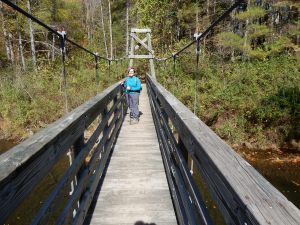
Usually, the beginning of a hike takes us out of a gap and up a mountain or steep incline to a ridge, but this was an exception. A smooth and easy trail, covered in autumn leaves, followed Brown Mountain Creek for nearly two miles. At Brown Mountain Creek Shelter we spotted a couple of backpackers, who appeared to be just beginning their day. Just beyond the shelter is a footbridge over the creek. A mile further we crossed the second footbridge, near a swimming hole, and then left the creek behind us.
The trail takes the long way around Lynchburgh Reservoir, but neither of us were complaining, as the trail afforded several nice views through the trees of the artificial lake and damn. Walking around several gullies reminded Maple of hiking the Tonto Trail in the Grand Canyon, where one has to walk around side canyons and creeks.
After circling around Lynchburgh Reservoir, at about the 6.5 mile point, we crossed the suspension bridge over Pedlar River and, then, began our 1200-foot ascent of Rice Mountain. The trail was still technically easy, but the mountain was the most difficult part of the day’s hike. While hiking up the mountain we came across two other hikers, the only ones we saw on the trail this day.
All-in-all, it was a pleasant day-hike of 10.9 miles. The trail itself was about as easy as one can find on a ten-mile stretch of the A.T., and the fall foliage and cool weather made for beautiful scenery and comfortable hiking.
Day Two: Blue Ridge Parkway to US-501
After a great hike the previous day, Birch and I were really looking forward to this hike. We, were wimps, I admit, and stayed overnight in a hotel. We needed to go over 10 miles and still have time to get home (5 hour drive) so going without all the backpacking gear seemed the best bet.
The hike began with a sharp ascent of about two miles. At the .4 mile mark we saw the turn off to Punchbowl Shelter. Punchbowl Mountain was not too impressive since there were no overlooks. We barely knew we had reached the summit. About a mile later we reached the top of Bluff Mountain and this had an amazing panoramic view of the Shenandoah Valley.
We had a one-mile descent and then things leveled off as we passed Saltlog Gap. There we saw one person camping. It was a pretty quiet day on the trail, considering that it was a Saturday with unusually warm weather.
 We stopped for coffee just before Big Rocky Row and
  then came to Fullers Rocks overlook. It was the perfect spot to take in the view, eat a sandwich, and rest in the sun. As we made the – descent we began seeing other folks going up the trail for a day hike. This included a rather rambunctious group of boy scouts (maybe 20?) all excited to be on the trail.
The last part of the hike is really beautiful. We walked along a beautiful stream and were able to enjoy a bit of serenity before having to make our way back home. Birch liked this hike better than yesterday but both are great day hikes.


