AT: NY-55 to Canopus Lake

This is the first time that Maple and I walked southbound north of Harper’s Ferry. The reason we chose to do this is the lack of parking at the trail junction on NY-55. We knew that there was plenty of parking by Conopus Lake, so that’s where we parked Saturday morning, August 17. From there we called an Uber, and we were picked up within 30 minutes. The driver, unfortunately, either had a terrible sense of direction or was unable to read his gps, so it took us an hour to get to our drop-off point in West Pawling. At 9:30, though, we were on the trail.

The first thing we noticed was the awful heat and humidity. Within 30 minutes we were soaked in our sweat, and we would remain soaking wet throughout the day. I suppose that thru-hikers can become somewhat acclimated to heat and humidity, but, together, they always take a heavy toll on Maple and me. As a result, these 12.4 miles to the RPH (Ralph’s Peak Hikers’) Cabin proved to be quite difficult—I think especially for me.
Three miles into our hike, we stopped at the Morgan Stewart Shelter to have a snack and to replenish our water at the hand-pumped well. Maple and I were carrying two liters each, but since we were sweating out every drop that we took in, there was no way that it was going to be sufficient to get us to the RPH Cabin.

8-17_11558-17_1326

One thing that certainly distinguished this section of trail is the prevalence of traffic noise. It seemed that we were almost always close to a major thoroughfare. In another 2 miles, we crossed over I-84, and for the next 3 miles, hiked parallel to it. Then, at Hosner Mountain, the trail turned so that it was adjacent to the Taconic State Parkway.

We stopped to eat our lunch on the trail steps off of Stormhill Mountain Road, just after crossing over I-84. The trail actually goes up this neighborhood road a little ways, and Maple and I wondered what the residents must think about all the hikers that walk down their road. It was so hot and humid that I lost most of my appetite, and could hardly manage half a sandwich. But, in another mile, at NY-52, we again stopped for a snack. Driving down NY-52 at the time was trail angel Bill, who stopped and offered to top off our water supply. Thank goodness! We needed every drop.

While hiking on top of the ridge of Hosner Mountain, we encountered several thru-hikers that were planning on getting to Katahdin before October. We wished them well, but privately wondered whether they would make it. Personally, I believe they should get to the Connecticut border, flip-flop, and then hike southward. However, I kept my opinions to myself.

Finally, we passed under the Taconic State Parkway and arrived at the RPH Cabin. We were utterly exhausted, and after setting up our tent, rested awhile. Then, we made dinner at the picnic table, pumped our water by the cabin, enjoyed a cup of coffee, and hit the sack. No sooner had we settled down, at about 9:00, than lightning and thunder announced the coming of a storm. Soon it hit, and it really poured. We felt a few drops pass through our tent, but no serious leaks.

8-18_0755

In the morning, we awoke to a day that was even more humid than the day before. We were the first up in camp and, after preparing breakfast and coffee, were on the trail by 8:00.

Sweat was soon pouring off of us, and by the time that we reached Long Hill Road, we had drank half of our water supply. To our good fortune, some anonymous trail angel had left gallons of water just off the road. Once again, thank goodness for the kindness of strangers! We drank up, filled up, and were on our way.

8-18_0920

After a couple more miles, we could hear people having fun at the beach of Canopus Lake. We had expected the trail to stretch out adjacent to the lake, but instead it remained on a very rocky ridge. The last two miles of our hike seemed to consist of a series of pointless ups and downs (or “puds”), but we finally arrived at a series of rock steps that brought us down from the ridge and, eventually, to our car. Maple cranked up the air conditioner, and in a few minutes we were on our way home.

8-18_09398-18_1040

AT: Bear Mountain State Park to Fahnestock State Park

This past weekend was a beautiful one for hiking! Bright blue skies without a hint of rain. Birch and I took an Uber from Canopus Lake to the Bear Mountain Inn and began hiking north by around 9 am. Unfortunately, the famous section of the AT through the zoo was not open, so we took the blue trail and crossed the bridge over the Hudson. After a short hike along NY-9D, we began our steepest ascent of the trip, up about 1000 ft to a peak known as “Anthony’s Nose” (supposedly named after a pre-revolutionary war sea captain).

Along the way, we ran into “Marmot”, a 70-year-old women who had thru hiked the AT about 30 years ago, and was now completing the north half of the trail, having done the south half last year. Marmot was enthusiastic and tenacious and was a great reminder that anything is possible.

Although the map shows many loop trails along the way, I really didn’t see them until we got to about 1 1/2 miles from the Graymoor Center. We crossed US 9 by a convenience store then quickly made our way to the Graymoor ballfield where we set up camp. The ballfield included plenty of picnic tables, water on tap, and even a shower. We settled in and relaxed, having the entire afternoon to read and enjoy the weather. Although we had heard that the center’s bells were loud, we actually enjoyed listening to them during the afternoon. We didn’t hear them at all at night.

In the morning, we awoke to quite a few more tents set up in the area. No one seemed particularly outgoing or friendly at 6 am so we quietly ate breakfast, broke camp, and got on the trail.

Our second day was much hotter than the first. Although there was not much elevation, we were sweating in no time.

The hike from the Graymoor to Canopus Lake felt like walking through a time machine. Old stone walls, the remnants of Revolutionary War era homesteads, seems to be everywhere. At one point we passed a plaque that marked where George Washington had inoculated troops against small pox. (Who knew that inoculations were possible then?!?)

It was at about this point that Birch and I hit a big milestone – our 1,000th mile on the AT! We were so excited! A hiker named “Digs” took our photo and gave us a fist bump, sending us on our way. We still needed to complete another 5 miles to get to our car.

We filled up with water at a pump station. The ascent to the Three Lakes Trail should have been super easy but the 90+ degree weather was a killer. We really had to take our time! The last two miles were very easy and we arrived at our car tired, but happy with our accomplishment.

AT: Crawford Notch to Pinkham Notch

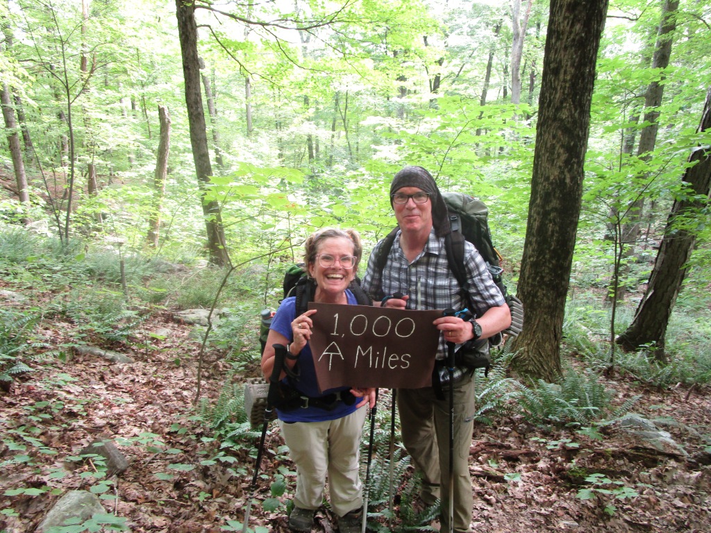
Day One: Crawford Notch to Mizpah Spring Hut

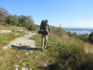
Birch and I awoke early in order to park our car near Pinkham Notch and catch a shuttle to Crawford Notch, US 301. It was a cloudy day, with rain and hail in the forecast, but as we began our hike no rain was in sight and it was a comfortable 55 degrees.

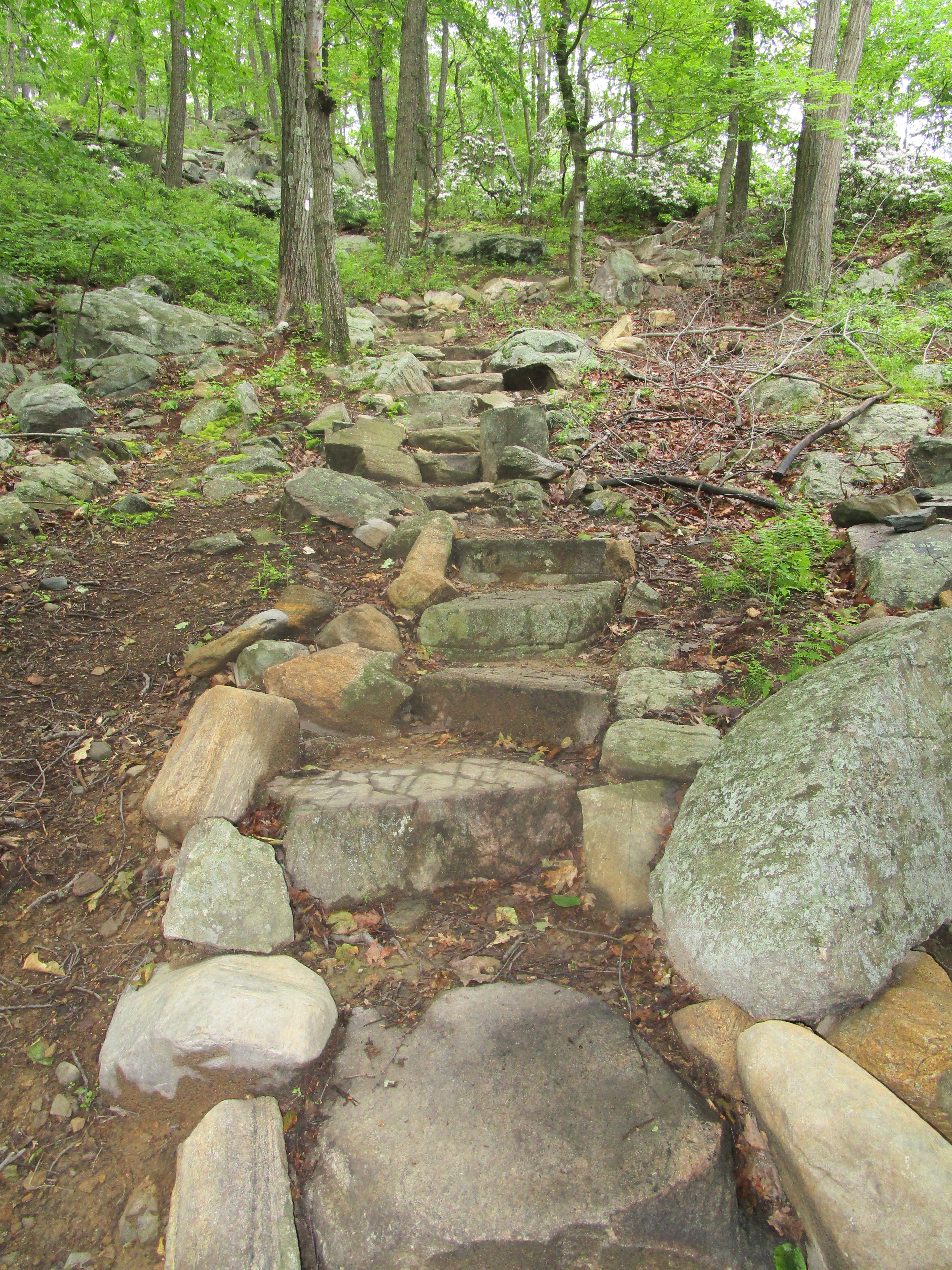
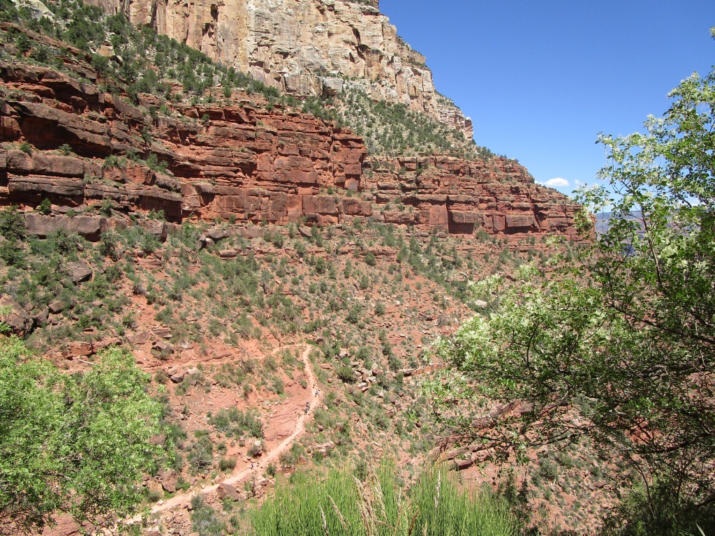
According to all maps, the 3 mile hike to Webster is brutal. It is about 3000 feet in elevation, practically straight up. But the first hour wasn’t too bad. I had the false hope that we were conquering it well. Within no time we were on the “top” of Webster – or so I thought. We took photos by the giant cairn and looked forward to the next few easy miles, which were supposed to be pretty flat.6-30_1035

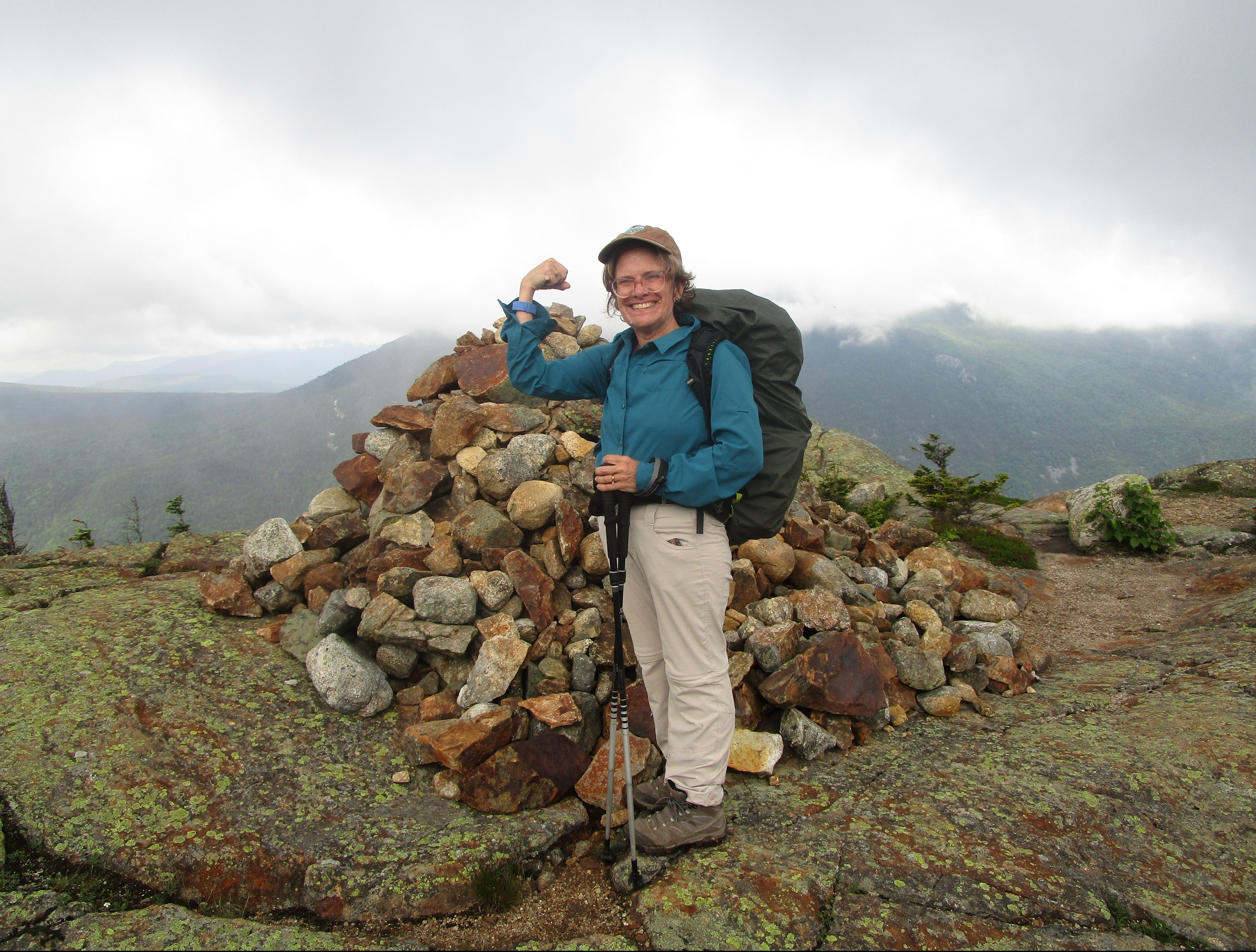
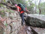
Unfortunately, things only got more difficult. Time after time we were confronted with large slabs of rock that went straight up. Desperately, we clung to pine branches to pull us up, or we grasped for rocks, hoping to make it to the next ledge. We kept finding more steep ascents before us. Was this Mount Jackson? No! Eventually a forest ranger came up the trail just as precipitation and thunder began. She told us that the Mt. Webster summit was just ahead but that we better get below tree line because of the weather. She turned around to go down the mountain, leaving us thoroughly depressed.

Just as we got to the top of Mt. Webster it began to rain and hail. The wind picked up and thunder was in the distance. We wolfed down a sandwich and scurried to get below tree line. However, if we thought the hard part was over it wasn’t the case. The trail was now a virtual river and we still encountered steep rock ascents, only now we were doing it on wet, slick slabs of granite. Mount Jackson was super windy and we both ended up taking spills. We slogged through pools of water above our ankles but we still had miles to go to get to Mizpah Hut.6-30_1333

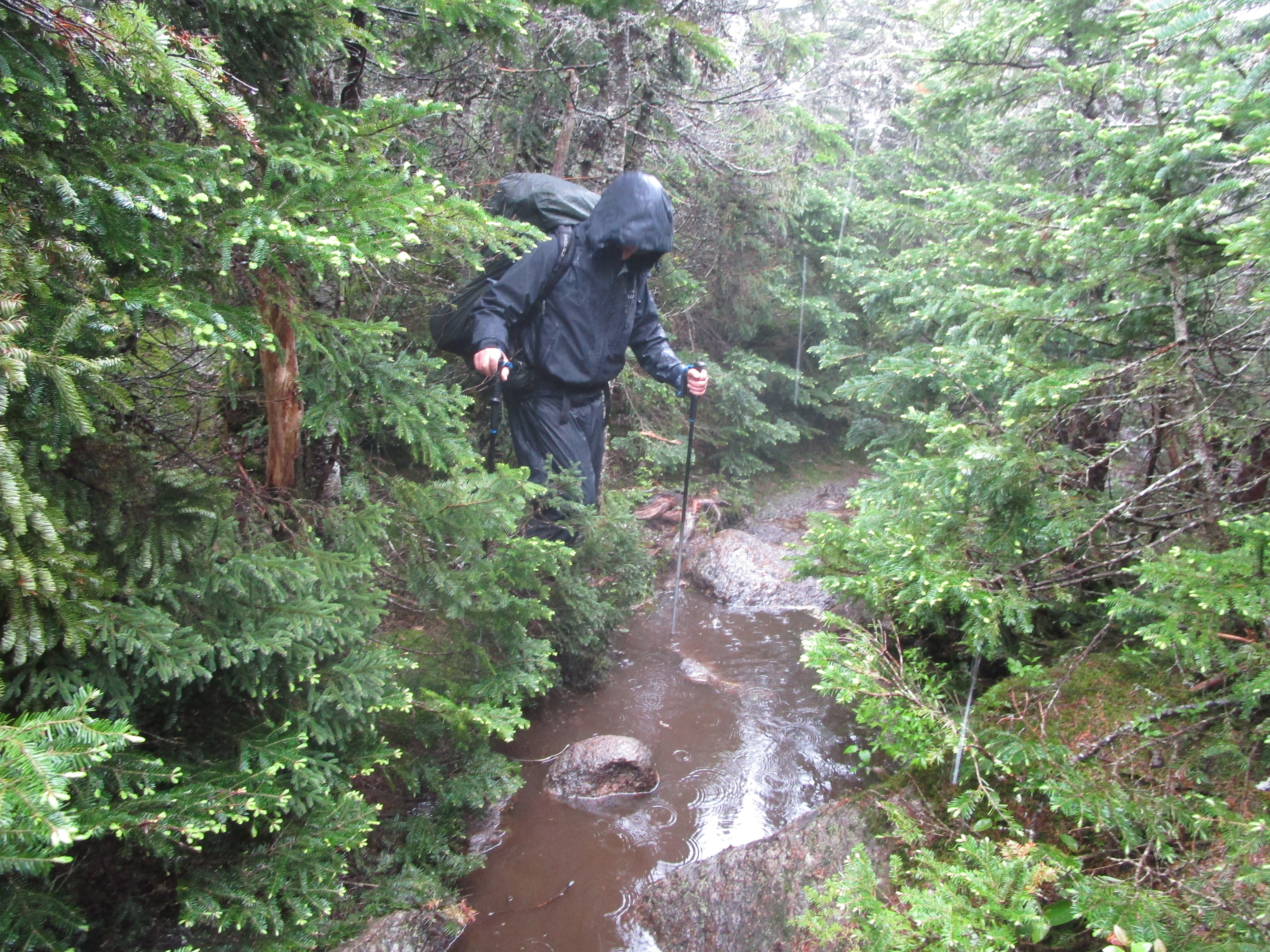
Then we arrived! Boy, that hut looked so good! The friendly staff assigned us to room #4. I took the top bunk and Birch took the lower one. We changed out of our sopping wet clothes and had a thoroughly enjoyable evening. Dinner was honey wheat bread, lentil soup, salad, pasta and broccoli. Chocolate cake was the dessert. We climbed into bed early, exhausted but pretty happy about our accomplishments.7-1_0806

Day Two: Mizpah Spring Hut to Lake of the Clouds Hut

This morning Maple and I were treated to a breakfast of oatmeal with peaches, pancakes with maple syrup, scrambled eggs, and bacon. Immediately after breakfast, we changed into our wet clothes and wet socks from yesterday, knowing that there would be plenty of puddles to wade through. We packed our backpacks and hit the trail, leaving Mizpah at 8:10.

The trail up Mt. Pierce was steep and required constant scrambling up rocks and boulders, but we soon reached the top. Once there, we had to deal with the water remaining on the trail, although the frequent bog boards helped somewhat. Still, putting on our wet socks seemed the right choice.7-1_0812

The trail got easier once we put Mt. Pierce behind us, although we still had plenty of large rocks to deal with. As we approached the cutoff trail to the peak of Mt. Eisenhower, we entered the alpine zone, above tree level. We were, however, immersed in clouds, so we had no distant views. In the alpine zone, there are no white blazes; we were really dependent upon the cairns to keep us on the trail.

As we approached Mt. Monroe, the wind really picked up, and Maple and I had to pull out our hooded fleeces. Just past the cutoff to Mt. Monroe, we found a place out of the wind where we paused for snacks and water.

Finally, at 12:30, we came around a bend and there it was—Lake of the Clouds Hut. We had made good time, and this reassured Maple that tomorrow we can make it to Madison Springs Hut.7-1_1220

The wet socks took a toll on my feet. They have been rubbed raw on every side. Fortunately, we have a first-aid kit stocked with “vitamin I”–that is, Ibuprofen.

Maple and I have been assigned bunk beds, once again, in Room 4. The bunks are three-tiered, and allow insufficient room to sit up in bed. Maple has the middle, allowing me the bottom. We have already taken a nap and are looking forward to a pot roast for dinner.

Day Three: Lake of the Clouds Hut to Madison Spring Hut.

Birch and I awoke before 5 a.m. in order to get moving early. I was super nervous about this hike, anticipating that it would be arduous. We quietly left all our bunkmates and packed up our gear, bringing it to the main hall so that we could organize it. Thru-hikers were tucked into their sleeping bags, scattered everywhere. (The Hut allows them to stay for free, in exchange for some work—but no bunks for them.)

We ate cereal that we brought, and a croo member kindly got up early to make us coffee!

We were out the door around 6 a.m., and as we began there was a bright yellow sign: “Stop! You are entering an area that has the worst weather in the world.” Okay. No need to ramp up my nerves was needed. The ascent to Mt. Washington was fairly easy. We were completely socked in by fog, so the hardest part was finding the next cairn. As we reached the top, the wind picked up.

Once at the top we hoped that we could, at least, stop inside for a minute, but it was before 8 a.m. and everything was closed. (I was kind of surprised that they don’t leave it open as a shelter from the weather.)7-2_0731

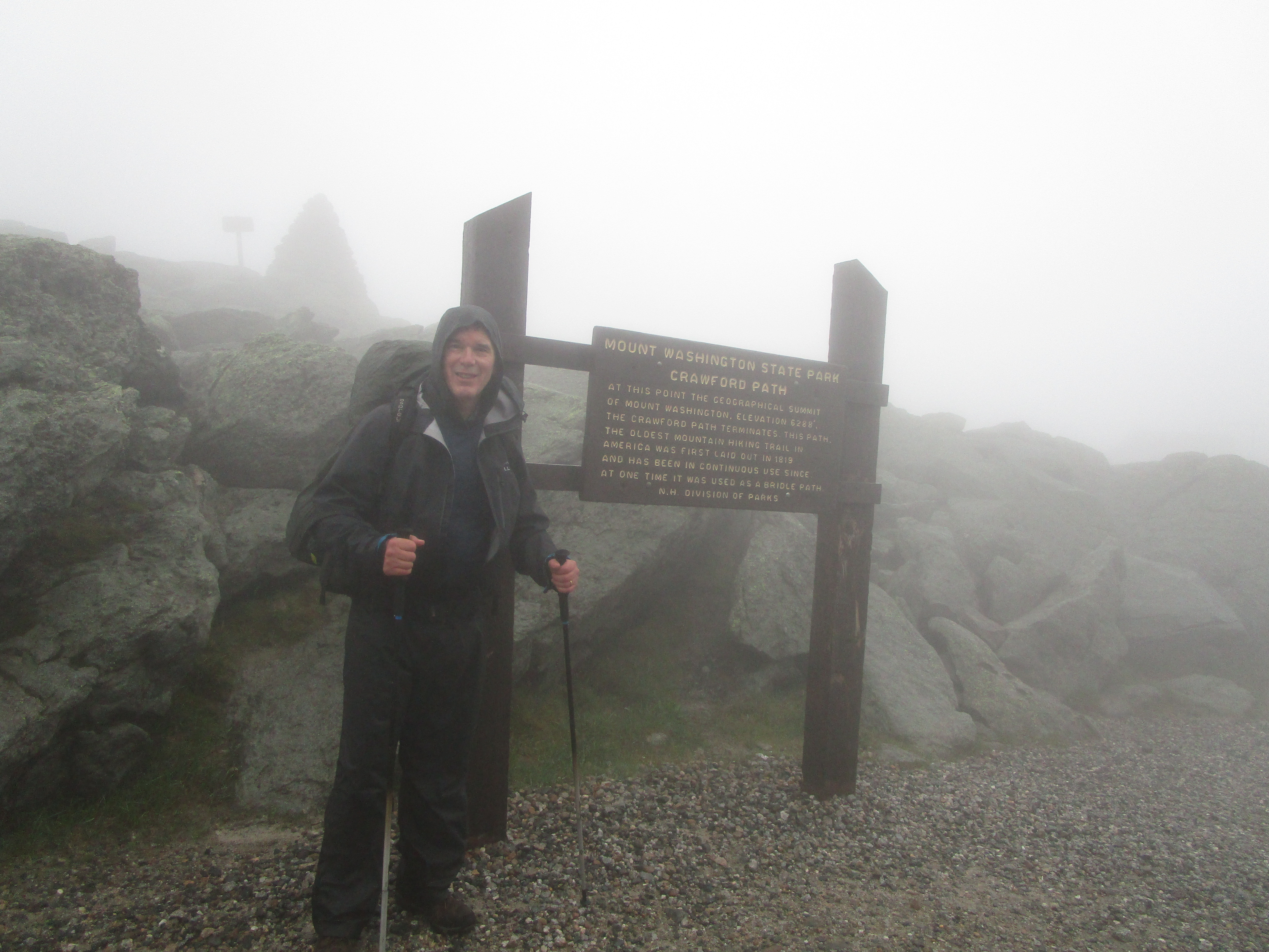
Once again, the rain started just as we reached the summit. Luckily, it was just spritzing. We took photos at a Mt. Washington sign, but not the summit sign—too windy!

Birch led us up and over. On the way down, it was super rocky, super windy, and super foggy. My glasses misted up so much that I just took them off.

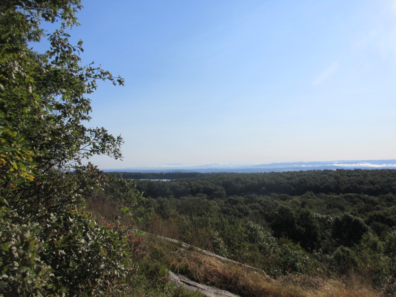
Once down about a quarter-mile, visibility improved. We crossed the railroad tracks and began hiking the ridge. After another hour the skies cleared and we could see into the valley! Beautiful. We could even see a puff of smoke from the train. This was my favorite part of the day. A slow descent. It was rocky, but it reminded me of Pennsylvania. Not bad.

One of the nice things about this hike is that there are many intersecting trails—so signs, with mileage, are everywhere. We climbed towards Mt. Jefferson, then went around the mountain and descended a very rocky path to another trail junction.

As we ascended, a ton of young people (20-25?) were coming the other way. It was a busy trail, with lots of day hikers, people doing the Presidential Traverse. I think the weather encouraged a lot of hikers. 7-2_1102

The last mile gave us beautiful views and fairly easy terrain, except for the .3 miles down to the hut. The view of Madison looks daunting!7-2_1349

Birch and I secured some awesome bunks, then hurried out. We played Scrabble at one of the dinner tables, while drinking coffee. Dinner was enchiladas. In all, it was a very nice day, but I’m exhausted!

Day Four: Madison Spring Hut to Osgood Tentsite.

I awoke Maple at 5:30 this morning, with a cup of coffee. Breakfast was at 7:00, and we were on the trail by 8:00. It’s been a beautiful day, with bright blue sky and gentle breezes. The view of Mt. Washington from the peak of Mt. Madison was unobscured.7-3_0843

We had a half-mile ascent over the rocks up Mt. Madison, and then a two-and-a-half mile descent. The going was slow, but we tried to be as careful as we could over the precarious terrain. It took us two hours to traverse the first mile, and five hours to get to Osgood Tentsite.7-3_1035

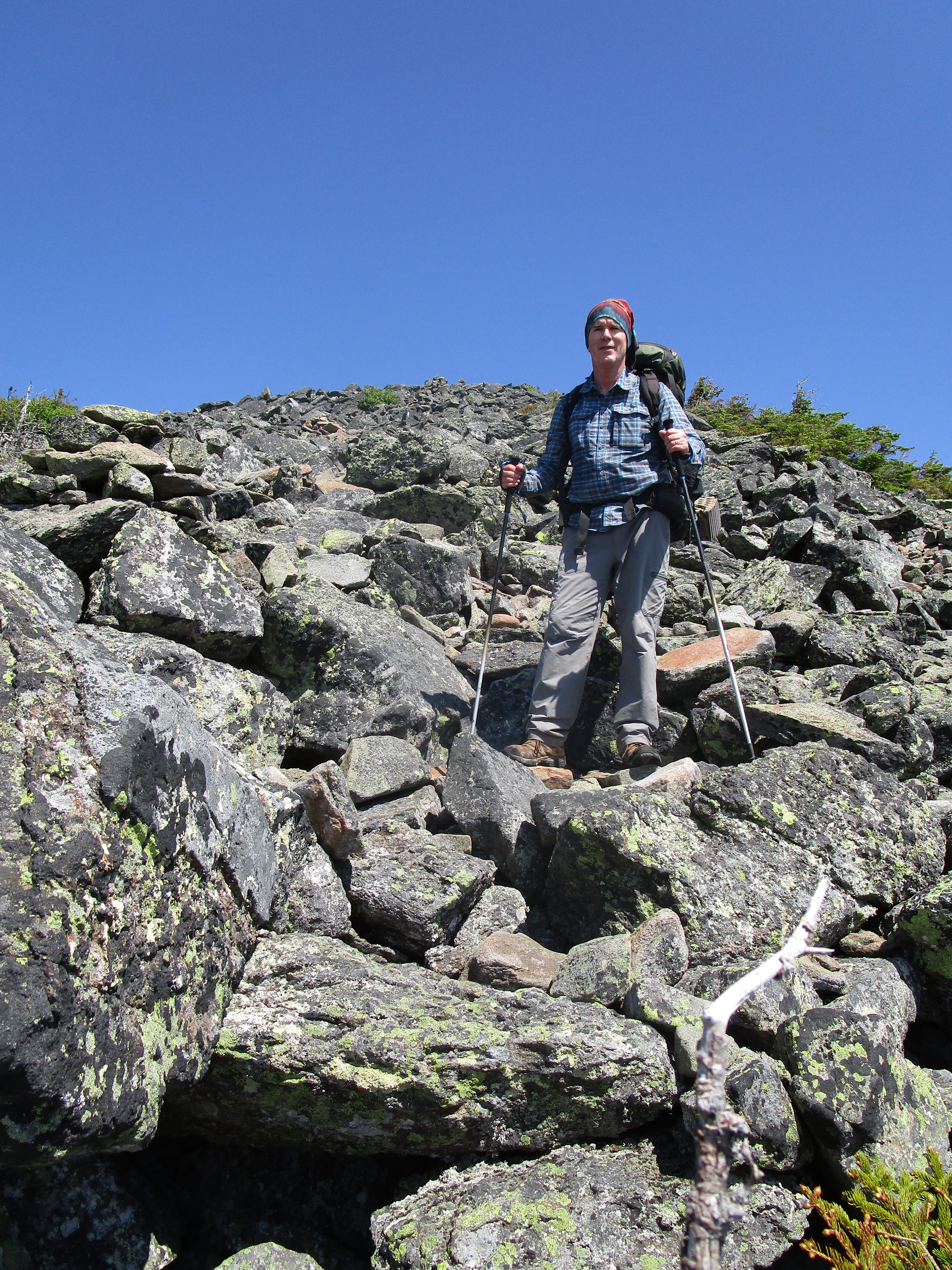
There were several day hikers from Madison Spring Hut who were making the ascent along with us, but on our descent we were pretty much alone. We met up with four or five people going up from Pinkham Notch and only one thru-hiker, who passed us up on our descent.

Maple had a couple of easy falls, but we both somehow managed to make it to Osgood without injury.

We have taken the second tent platform, close to our water source. Maple put to use our new Sawyer Squeeze water-filtration system, and seems to have had a good experience with it. We’ve already had coffee and had a nice nap.

We are both looking forward to our arrival at Pinkham Notch tomorrow, but we are also enjoying our down time at Osgood. Were it not for the mosquitos, our camping experience here would be almost idyllic. 7-3_1558

Day Five: Osgood Tentsite to Pinkham Notch.

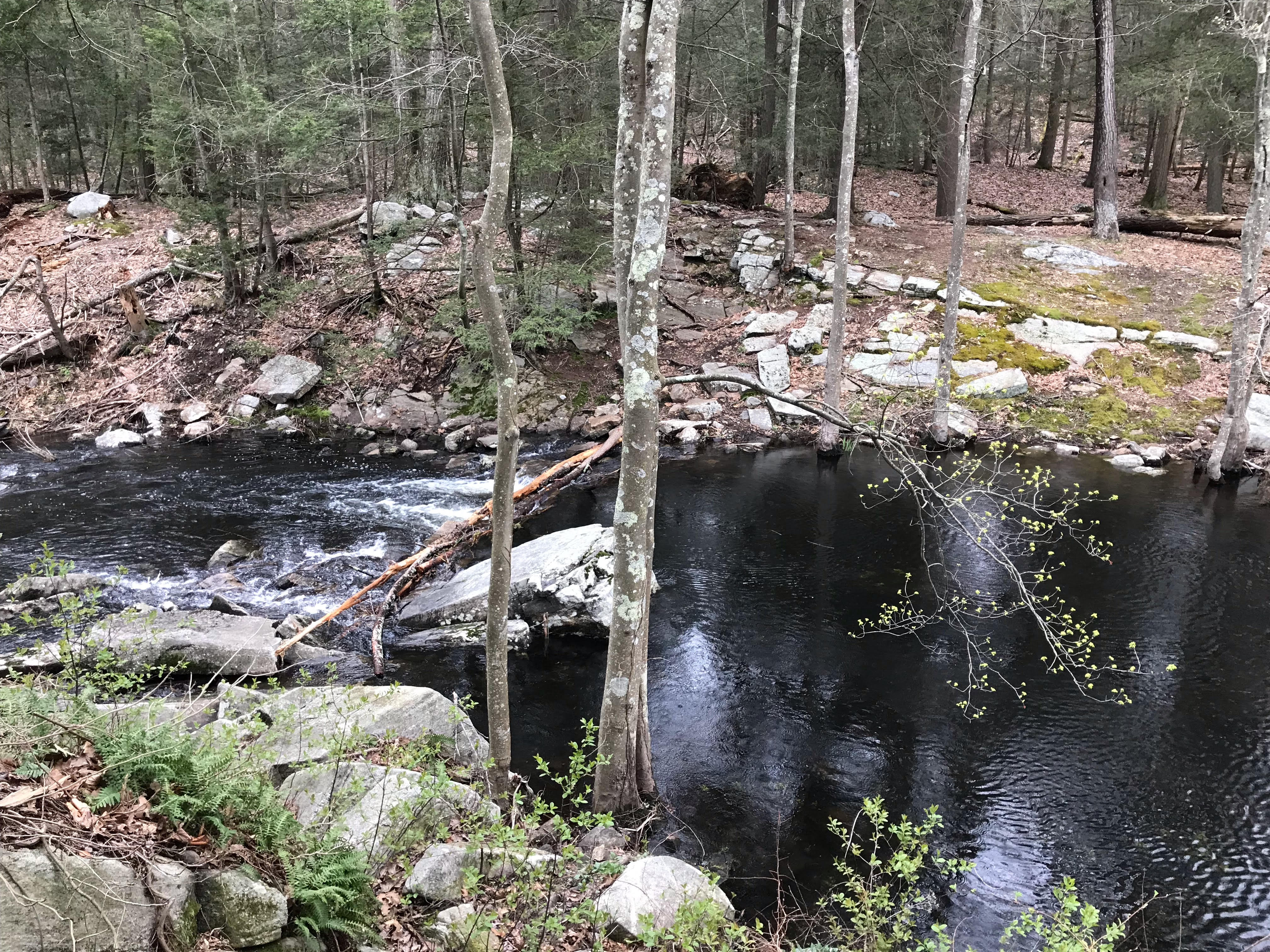
The sun comes up early this time of year, so we were up early as well. By 6:30 am we had packed up and had eaten breakfast.  This trail was so different than the others we had experienced this trip.  It was much easier to  navigate.  In many ways this hike could be called the trail of waterfalls. We saw so many beautiful water sources along the way.  A highlight of the hike was the opportunity to walk over a suspension bridge. It swayed a bit but was lots of fun.7-4_0709

The trail has a gradual ascent that is very mild by the standards of the Whites.  With about 2 miles to go we crossed the Mount Washington Auto Road, where a tour van had slowed to show the passengers where the AT was located.  I felt a little on display as I waved to the folks who were taking the easy way down the mountain!

The last mile was super easy and I couldn’t help but feel a little sad that our adventure was coming to an end. It was nice to see the Pinkham Notch Visitors Center and I’m so happy that we had such a successful, injury-free experience.

AT: NY-17 to Bear Mountain Inn

Day One: NY-17 to William Brien Memorial Shelter

On Friday evening, June 14, Maple and I arrived at Bear Mountain Inn, on the west side of the Hudson River, New York. We were booked to stay in the Overlook Lodge. It’s a beautiful Inn, and our stay would have been perfect had it not been for a large group of boys who were loud until midnight. Still, the front desk clerk gave us a generous refund for the disturbance, so I really can’t complain.6-14_1553

Maple and I had a good breakfast at the 1915 Restaurant, and were, afterwards, picked up by Jossie’s Shuttle, and once again Richard, Jossie’s husband, was right on time. We were on the trail by 8:20 in the morning.

In about an hour we arrived at the “Lemon Squeezer,” where the AT passes through a narrow crevice between two boulders. Managing one’s backpack is the only real difficulty here. Almost anyone can skirt sideways and upward through the “Lemon Squeezer,” but if one has a large and heavy backpack, lifting it up sideways with one arm can prove challenging. The key is to get one’s backpack up onto the flat ledge above oneself as quickly as possible.

6-15_0924

The AT, as it traverses Harriman State Park, is not at all difficult. There is, however, a lot of flat rock, which may be slippery when wet. Maple and I saw a group of older ladies and a group of young girls hiking the path. Moreover, in mid-June, the Mountain Laurel is in bloom, and the fern is at its peak. It’s really quite a beautiful park.

6-15_0953

Our destination for the night, the William Brien Memorial Shelter, does not have a very appealing water source. The spring-fed well there is described by some as stagnant and covered with leaves. Therefore, Maple and I decided to fill up at the stream that is just before Seven Lakes Parkway, which feeds into Lake Nawahunta. There was a large rock in the middle of the stream, where we could sit and pump our water through the filter. We use the Katahdin Hiker Pro. Unfortunately, halfway through the process, the filter clogged, making the pump impossible to use. We spent an hour at the stream, attempting to unclog our filter. (This is the second or third time we’ve had this problem.) We were forced to accept the amount of water we had, though it required that we conserve.

We reached the shelter at about 3:00, set up camp, prepared ourselves a cup of coffee, and relaxed for awhile, prior to making dinner. The tent spaces at the shelter are nicely separated, and the area is quite beautiful. Maple and I enjoyed our stay here. We retired early, and slept well, but were awoken by the rain that fell at scattered intervals throughout the night.

Day Two: William Brien Memorial Shelter to Bear Mountain Inn.

Rain was forecast throughout the next day, but we were quite lucky. Although we had some sprinkles, it did not start raining in earnest until we were most of the way down Bear Mountain. Nevertheless, anticipating constant rain, but finding ourselves in a dry interval, Maple and I got up early and were on the trail by 6:45.

We had three mountains to traverse this day: Black Mountain, West Mountain, and Bear Mountain. It would be a day of significant ups and downs. The phenomenon that really made this day interesting was the rock stairs. I believe that these are created over billions of years, through processes of geological layering and erosion. Not only are they evidence of divine design, but they make hiking much easier. As Maple says, they are proof of God’s love for hikers and that he wants people to hike. We encountered rock stairs on all three mountains, but especially on Bear Mountain. Of course, I am aware of the argument that these stairs are of human design, but the incredible amount of physical exertion required to build such stairs is entirely foreign to human nature, which is fundamentally lazy; therefore, I stick to my belief.

6-16_0720

Maple and I got a good view of Perkins Memorial Tower from West Mountain. Maple said that it looked to be twenty miles away. Fortunately, it wasn’t. We arrived at the tower just before noon. This was Father’s Day, and the top of Bear Mountain, as well as the bottom (at Bear Mountain Inn) was crowded. From the top of Bear Mountain to the bottom the AT was graded and graveled, so it was really quite easy, though a little hard on the knees, going down.

6-16_1156

We arrived at the Inn soaking wet and thirsty, but after changing into dry clothes in the restrooms, Maple and I rehydrated ourselves at the Hiker’s Coffee Shop. We high-fived our backpacking success, and were soon on our way home.

Grand Canyon: North Rim to South Rim

On May 15th, Tod and I traveled to the Grand Canyon National Park, North Rim, to begin one of our “bucket list” hikes, a rim-to-rim of the Grand Canyon. We arrived on the South Rim on the 14th and on the morning of the 15th we hopped upon the first Trans Canyon Shuttle trip of the season. Our van included three other hikers, including a couple from Michigan and a man from Seattle who works for REI. It is a 4.5 hour trip that goes through Cameron and then through the Navajo Reservation. Beautiful! Our driver was a great tour guide.

The North Rim park is much smaller and more isolated than the South Rim. We had lunch, secured a cabin, and were just getting ready to go back to view the canyon when the power went out – and came back on – and went out again. A small panic set in since food service was impacted and we really wanted a decent meal before our morning decent. Luckily, the park sold us some cold sandwiches for dinner. By the time we awoke in the morning, we had power again.

A shuttle drove us to the trailhead at 5 am. It was still dark but the sun was beginning to rise and, as we hiked through the large pine trees, we soon came upon the canyon itself. The first part of the North Kaibab Trail was very steep, with lots of switchbacks and opportunities for gorgeous views. We quickly arrived at Coconino Overlook (.7 miles) then the Supai Tunnel. At 2.6 miles, and 2200 ft from the top, we arrived at Redwall Bridge. From here we had opportunities to hike along a trail that hugged the canyon and gave us views of waterfalls. My legs were wobbly and felt as limp as spaghetti but we soon arrived at Manzanita Rest Area and this gave us a chance to load up on water, take a bathroom break, and enjoy some snacks. We arrived well before 8 am and were making great time! Manzanita is 4.7 miles down and over 3800 feet from the top.

From here we followed the Bright Angel Creek on the North Kaibab Trail, passing the Cottonwood Campsite which did not yet have water available. Thankfully, it was relatively cool (low 80s). (Note: if you ever plan to camp here arrive early to get a site that is in the shade!) Then, we arrived at the Ribbon Falls turnoff hoping to take the side trail. Unfortunately, the bridge was closed due to damage and the water flow of the creek made it impossible to ford. After taking a break here we moved on and were at least able to see the falls from trail.

View of Ribbon Falls from the North Kaibab Trail

Both Tod and I were not looking forward to the “box”, an area of the trail that goes through a narrow section of the canyons and is supposed to be very hot and confining. As we trudged along I was getting super hot and tired and was wishing that we could avoid it. Luckily for us, we were actually in the “box” but didn’t realize it. Before we knew it, we arrived at a sign that said we were only 3/4 of a mile from the Bright Angel Campground. We soon arrived at Phantom Ranch, checked in, and had a couple of glasses of their famous lemonade before heading to set up our campsite. I was not able to really enjoy it, and I now realize that I had a bit of heat exhaustion due to a lack of salt in my system. That won’t happen again!

Bright Angel Campground

We found a tent site right by the Creek and set up. Soon the winds picked up and we scrambled to put rocks on each tent stake as well as huge boulders inside the tent. As the winds battered our tent we found that at least one of us had to stay inside the tent to keep it from flying away! Would this last the night? If so, we were in big trouble! Fortunately, the winds died down by around 8 pm and we were able to get some sleep.

The next day we were excited to have a full day to ourselves at the Ranch. We had a leisurely breakfast and enjoyed sitting in our camp chairs by the creek, watching the mules arrive and depart. We took a day hike along the River Trail and had a chance to enjoy lunch overlooking the silver bridge. We hung out at Phantom Ranch drinking lemonade, playing backgammon, and mailing postcards. In the afternoon we checked into our dorms – barracks that accommodated 10 women or men. My dorm included a woman from my hometown in Minnesota!

The highlight of any Ranch trip is the food. Tod and I ordered the stew dinners and they were awesome! You have no idea how good food tastes when you know it has been brought down by mule and you are among the select few who have been brave enough (or crazy enough?) to be there. Across from me was an alum from American University (where I work) and the waiter was from our town.

By 7:30 pm everyone in the dorm had come back from dinner and were ready for sleep. Crashed! It was the perfect example of how hikers might have energetic days but are totally wiped out by the end of the day. We got our wake up call at 4:30 am for the 5 am breakfast. All of us were up and ready for the day, excited to hike out of the Canyon.

Tod and I made quick work of getting to Indian Gardens, which is the camp area on the Bright Angel Trail that is about 5 miles from Phantom Ranch and 4.5 miles from the rim. We took a nice long break here so that we could eat snacks and top off with a bit of water before hiking up the last 3000+ feet in elevation. By now, the temps had begun to inch up, the crowds began to appear, and the sun came out. It seemd to take forever to get to the first rest house at “mile 3” (from the top). Then again at mile 1.5. We took plenty of stops and sometimes our fellow hikers passed us, sometimes we passed them. While it was slow going (slower than we would have liked, anyway) we finally made it to the top and to the Kolb house. We had completed a rim-to-rim!

In all, we were fortunate to have fairly good weather, plenty of food, and available water. Right after we left the north rim, the winds whipped up and they had snow. The South Rim had snow right after we left. However, it could have been just the opposite problem – heat. On a side note, throughout our trip, we were struck by the incredible number of “trail runners” on the trails. These are athletes who plan to hike the canyon in one day, and carry little but water and a few snacks. Some seem to have little knowledge of trail etiquette and many do not seem to be prepared for contingency situations like rain and snow. A rim-to-rim trip is an amazing experience! Be prepared for multiple scenarios and have fun!

AT: NY-17A to NY-17

After spending the night in a hotel in Secaucus, New Jersey, Maple and I made our way on Saturday morning, April 20, to the Elk Pen Hiker’s Lot on the outskirts of Harriman State Park, New York. The weather report had called for torrential rains, so we put on our rain gear and waited for Josie’s Shuttle. Soon, a man pulled up behind us, and announced that he was Josie. His voice didn’t match the Josie I had spoken with on the phone, but we got in anyway. His name turned out to be Richard, and he was a pleasant gentleman, who charged a very reasonable rate.

Richard dropped us off at NY-17A, and our hike began. Soon we reached the Pinnacles and, afterwards, Cat Rocks, both obstacles requiring scrambling over wet, slippery, and treacherous rocks. 4-20-1046Maple and I took our time, as we knew we had all day to make it to Wildcat Shelter. Still, I slipped and landed hard on my butt. We both crab walked more than once down moss-covered inclines. We could see the blue (safe) trail that skirted around the Pinnacles and Cat Rocks, but Maple and I are committed to the white blazes. Is that rational? Probably not, but it lets us say with pride that we are AT purists.

Soon after Cat Rocks, we made it to the shelter. After getting out of our wet clothes, we prepared our lunch, made ourselves coffee, and then, . . . when it looked like the rain would hold off a bit, we set up our tent and took a nap. When we arose, the tent was soaking wet, and several other hikers had showed up.

We introduced ourselves and found that one young man was a trail runner, who had covered over 40 miles that day northbound. That stretched my imagination to the breaking point, since the terrain he had covered was far from smooth. There were bogs to navigate, rocks to scramble over, and brooks to cross. Even so, I see that Jennifer Pharr Davis, according to her 2008 Itinerary, achieved the same mileage over this territory. I’m simply amazed!

We arose early the following morning, Easter Sunday, and were the first to depart from the shelter. Soon, we reached Fitzgerald Falls, paused to take photos of this beautiful area, and then proceeded, crossing the stream twice over rocks. During the first 5 miles we made great time, covering 2 miles per hour. But then we ran into a series of mountains, each requiring cautious scrambling.4-21_0841

To slow us down even further, biting gnats were out in force, not only biting, but flying into our mouths, our eyes, our noses, and our ears. When we needed most to concentrate on our footing, they seemed most bent on distracting us. It was maddening! Maple was attacked relentlessly, and after our hike needed medical attention for the swelling that ensued.

Just beyond East Mombasha Rd., there is a stream that runs into Little Dam Lake. When we reached it, I had a few choice words to express myself, for there was no bridge to cross or rocks to traverse. Maple and I had no choice but to ford it, and we could not see the bottom. Just then, it started raining again. I figured we would get soaked anyway, so we might as well go in with boots and pants. Maple practically dived in to the challenge. Before she was across, I followed. I’m 5’10”, and the water was just up a ways from my crotch. It was up to Maple’s waist. I forgot that I had our camera in my pants pocket. It was ruined, but fortunately the photo card was salvageable.4-21_1117

Just for the record, there is a beautiful camping area on the north side of this stream. Maple and I were exhausted at this point, but pressed on.

Our next obstacle was Arden Mountain, from the top of which we could clearly see NY-17 and the Elk Pen Hiker’s Lot. The descent from this mountain was more difficult and treacherous than the ascent. Still, we made it down safely and back to our car.

Altogether, this was one of the more difficult AT sections that we have hiked. It was quite an adventure!

AT: NJ 94 Vernon to NY 17a. Belvale, NY

This past weekend Birch and I went backpacking so that we could finish the New Jersey portion of the Appalachian Trail. Getting to NJ 94 wasn’t easy. There were very few shuttle options from our drop off point to the trail head. For this reason, we had to settle for a taxi service with a late pick up time.

IMG_0890

As we waited for the taxi the wind began to blow and the flurries began to fly. This was not going to be a warm weekend! The first part of the trail is known as the “stairway to heaven”. It is a short (1.4 mile) but steep ascent up Wawayanda Mountain that is fortunate to have many sets of stairs that make the hike interesting. There were a ton of day hikers who went up to enjoy the beautiful views. We, however, had mileage to make!

Unfortunately, our late start and the early sunset made it impossible to get to Wawayanda Shelter as we had hoped. Instead, we filled up with water at a stream just south of Barrett Road, crossed Barrett Road, made our way into the woods, and resigned ourselves to setting up camp. The sun was low, so we only had time for a cup of coffee and a cold sandwich before hitting the sack.

In the morning, we quickly made our way past Wawayanda Shelter and through a beautiful wooded area. After lunch, we began our climb up to the ridge. This included several places where I had to scramble and one area that had a very cool ladder that took us up to the ridge and across Prospect Rock to the highest point on the AT in New York. Again, we saw some day hikers who had come up to the area from a side trail. Once on the ridge we came to the New Jersey – New York state line. Another state complete!

This section of the New Jersey/ New York AT was surprisingly challenging. Although there is very little change in elevation, the ridge requires lots of short climbs, up and down, over a series of rocks. This slowed us down considerably! Another challenge was that the leaves had recently fallen on the trail, making following the trail very difficult at times. Thank goodness for the great job that the New York New Jersey Trail Conference did with its blazes. It saved us!

Instead of making up time from the previous day, we resigned ourselves to stopping short of the next shelter.  Given our time constraints, we agreed to end our hike at New York 17a the next day.  Weather throughout our trip was cold. After a warm dinner we tucked ourselves in for the night and when we awoke our water bottles were frozen. However, we had plenty of warm weather clothing, sleeping bag liners, and other gear that made us able to enjoy the trip despite the cool temps. The last day we had a very short hike to make it to our destination. Once off the ridge, the hike was very easy. We look forward to coming back when the weather warms up a bit.

AT: High Point State Park to NJ-94

After spending the night in Vernon, Maple and I dropped off our car at the AT crossing on NJ-94 and were picked up by our shuttle driver. Once again, we relied upon George Lightcap, and it has been our pleasure to get acquainted with him.

The morning was foggy, and the High Point monument was almost entirely shielded from view. But, despite the clouds and the chill in the air, it was going to turn into a beautiful autumn day, ideal for backpacking.
10-20_0842
Once we passed High Point Shelter, we ran into two fellow section hikers, Waldo, her dog, and friend, Chad, who were traveling in the same direction.

Six miles into our hike, we stopped at a footbridge over a stream and topped off our water, just to make certain that we had enough to cook a hot lunch of ramen noodles. But, before having lunch, we decided to go a bit further.

And, then, we had a little accident. While traveling over the puncheons through Vernie Swamp, Maple slipped and went feet first into the swamp. Unfortunately, she also, then, lost her balance, and went down onto her hands and knees. Only her backpack stayed above the water and muck. In a panic, I stepped onto the same wet spot on the plank and slipped off into the swamp. I stayed upright on my feet, in eight inches of mud and muck, and with water up to my knees. We both managed to quickly get ourselves back onto the puncheons, but the damage was done. I must say, though, that Maple handled the event marvelously: no screaming, no whining, no moaning.  I even heard her say, “It’s all good.”
10-20_1211
Both of us had soaking wet boots, but Maple was thoroughly drenched and, on top of that, smelling worse than a thru-hiker. So, when we stopped to cook our lunch, she changed her clothes.

Our original plan was to stop in Unionville, NY, and set up camp in the town’s park, which has been made available for that purpose to AT hikers. However, upon arriving at Lott Rd., we decided to press on and try to get to Pochuck Mountain Shelter before nightfall.

There’s a half-mile stretch where the AT runs parallel to NJ-284, and then makes a left turn to cross the road. Maple and I both missed the left turn, and consequently had to walk through a bog several inches deep. We cleared the bog and pressed on for another hundred yards or so before realizing our mistake. Not wanting to retrace our steps through the bog, we bushwacked our way through some thorny bushes until we spotted a couple of hikers and knew we had found our way back to the trail.

Just across NJ-284 there is a steam. We filled our dromedary there, and I carried our water for the next six miles, including the mile-and-a-half through the Wallkill River National Wildlife Refuge. With the recent cold weather, most of the birds appear to have gone south, but Maple and I did see ducks and a crane.

We arrived at Pochuck Mountain Shelter just before nightfall, quickly set up our tent and made ourselves coffee. And then, after sunset, cooked our dinner. By the time we visited the shelter, it was too dark to see and Waldo and Chad had already retired for the night. It was time for Maple and I to retire, as well. We were exhausted.

It rained during the night, and the temperature dropped below freezing, so there was a layer of frost over everything when we awoke in the morning—twelve hours later. By 9:30 we were packed up and ready to get back on the trail.

The highlight of day two was definitely passing over the Pochuck Boardwalk, a remarkable accomplishment of engineering. It follows a circuitous route through Vernon Valley and, by means of a suspension bridge, crosses over Pochuck Creek. Beyond the boardwalk are more puncheons, eventually leading us to NJ-94 and the end of our trip.

AT: Culver Gap to High Point State Park

It is the last weekend in September and we were excited at the prospect of hiking in sunny weather! Our trusty shuttle driver, George, dropped us off at Culver Gap early in the morning and we were able to make quick progress from Culver Gap to the fire tower, about two miles away. The view from the top was basically non-existent, given that it was very foggy. But it was beautiful nonetheless.

This section of the AT is flat but rocky. The biggest challenge was not the trail itself, but the incredible amount of water that turned the AT into a swamp. There were places where  we had to navigate way around the trail in order to avoid moats. The first day we had the pleasure of seeing the Sunrise Mountain pavilion, an enormous stone structure with beautiful wood beams and breathtaking views.

The highlight of the hike was an amazing encounter with “Maps.” We first met Maps at Guyot Shelter in New Hampshire, the day that Birch had terrible knee pain. As we turned the corner on the New Jersey trail, we saw him sitting on a rock taking a break. “Hey, I know you guys,” he said! What were the chances of us meeting up with him again? Maps had completed the northern part of the trail and had flip flopped in Connecticut. We wished him well and hope he makes a ton of progress this Fall.

We stayed overnight at Mashipacong Shelter. Built in the 1930s by the Conservation Corps, the shelter itself is kind of dark and low to the ground. It had a nice lawn in front of it and it is here that we decided to set up our tent (not realizing that we probably could have gone into the woods for more private tenting options.) This shelter does not have a water source, so Birch carried 6 liters of water with him so that we would be set. However, the shelter caretaker supplied the shelter with gallons of water, set in the bear box. We enjoyed a restful afternoon at our tent spot, reading and drinking coffee. We were amused to see many dogs, in all shapes and sizes. Two stayed at the shelter, including “Millie” (or Mildred when she was in trouble), an affectionate boxer with a bright blue coat that kept her warm.9-30_0742

It was a chilly night but we slept well and were up and out of camp before 8 am. The remaining part of the trail was just as wet but it offered some beautiful views. The mile just south of the High Point State Park office was about as muddy as it gets. All in all, it was a great fun and we look forward to completing New Jersey soon!

9-30_0921


AT: Millwood/Blairstown Road to Culver’s Gap

Day One: Millwood/Blairstown Road to Brink Road Shelter

Once again, Maple and I enjoyed the shuttle service provided by George Lightcap of Newton, NJ. He picked us up promptly at 8:30 at Culver’s Gap and transported us, together with a fellow hiker, Glenn, to Millwood/Blairstown Road. After a couple weeks of rain, it was fortuitous to have a day of sunshine, with clouds—even though the humidity was rather high.

There were a couple of places requiring scrambling and hiking over a rock field, but overall, I’d say that the 10.9 mile hike to Brink Road Shelter was easier than the average AT hike. What made it more difficult for Maple was that one of her hiking poles broke during the first mile. It snapped in two where the sections joined together. We tried using duct tape, but that solution failed miserably.

I saw several salamanders and frogs on the trail during this trip—perhaps, because of all the rain we’ve had recently.

Just before leaving on this trip, I purchased a second Helinox Chair Zero—an excellent chair to bring backpacking, weighing only 1 pound each. I carried both, and Maple and I were able to enjoy a nice lunch break at a place that had no convenient rocks or logs to sit on.

Just before climbing Rattlesnake Mountain, we came to a nicely constructed bridge over a brook, compliments of the Boy Scouts. Rattlesnake Mountain was, I think, the most precipitous and rocky ascent that we had this day, but the view to the north from the top was certainly worth it. There we stopped and took a short break.

9-15_1725When we got to Brink Road Shelter, we found that the ground in front of it was under water. The water stretched out over the road, and most of the way toward the spring—so it was no simple task to make our way to the spring to fill up our dromedary. Once we got there, we found that our water filter would not pump. Ultimately, we decided to take our chances, and take our water directly from the source of the spring, without filtering.

Day Two: Brink Road Shelter to Culver’s Gap

We awoke in our tent on day two to the sound of light rainfall. This was not in the forecast. In fact, the weather report said there was no chance of rain in Newton, just ten miles to the south. Even so, the sprinkling was not bad, and Maple and I got out of our tent and enjoyed a cup of coffee and oatmeal for breakfast.

We didn’t get far on our second day’s journey, without noticing the saturation of the forest with spider webs. Webs crossed the trail, and we both had to use our trekking poles to clear the way before us.9-16_0936

After about an hour, we were out of the spider infested forest. Soon we had to make our steep descent from Kittatinny Mountain to Culver’s Gap.

We had fun, and look forward to continuing our journey in two weeks.

9-16_1025

Birch, with Culver Lake in the background.